

Midday Nowcast: Dry Tuesday, Rain and Storms Rest of Week
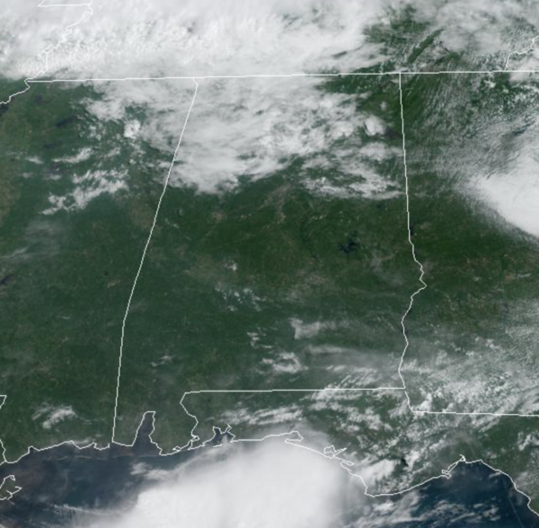
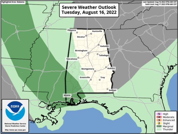
It is mainly sunny for much of North and Central Alabama with temperatures in the upper 80s to lower 90s. We are seeing some clouds move into North Alabama, but despite these, we should stay generally dry today, while the better chance for rain and storms today is across Southwest Alabama where the SPC maintains a “marginal risk” of severe storms today.
RAIN AND STORMS RETURN: A northwest to southeast boundary is in place across the state, and that will allow impulses of energy to ride along it bringing rain and storms back to Alabama tomorrow through Friday. These three days will feature more clouds with occasional rounds of showers and storms at times. It won’t rain all the time and it won’t rain everywhere but these days will feature rain chances in the 70-80% range.
We can’t rule out some stronger storms along the way with the main concern gusty winds, but remember, summer storms will produce loads of lightning, and of course intense tropical downpours would could lead to areas of isolated flash flooding. With the clouds and rain, highs should hold in the mid 80s these days. Of course rainfall distribution will remain very uneven; and most of the rain and storm will come during the afternoon and evening hours, but with this set-up, we could certainly see rain and storms overnight and during the morning hours as well.
FOOTBALL WEATHER: The high school football season kicks off Friday night for most schools; the weather will be warm and humid, and random storms will be around during the evening hours. No way of knowing in advance the exact locations, but a few games could experience a lightning delay. Temperatures will be in the low to mid 80s at kickoff, falling into the upper 70s by the second half.
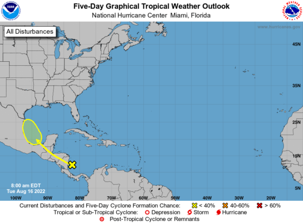
IN THE TROPICS: A tropical wave currently located over the southwestern Caribbean Sea is forecast to move across Central America during the next few days and emerge over the Bay of Campeche, where an area of low pressure could form on Friday. Some gradual development of this system is possible while it moves northwestward over the southwestern Gulf of Mexico through the weekend. Formation chance through 5 days…low…20 percent.
WEEKEND WEATHER: Rain chances remain high for Saturday and Sunday, and therefore we will see more clouds than sun with scattered showers and storms at times. Weekend highs will remain in the upper 80s.
NEXT WEEK: Expect a mix of sun and clouds each day with scattered, mostly afternoon and evening showers and thunderstorms through the week. Highs will remain below 90 degrees on most days.
BEACH FORECAST CENTER: Get the latest weather and rip current forecasts for the beaches from Fort Morgan to Panama City on our Beach Forecast Center page. There, you can select the forecast of the region that you are interested in visiting.
WORLD TEMPERATURE EXTREMES: Over the last 24 hours, the highest observation outside the U.S. was 122.7F at Ahwaz, Iran. The lowest observation was -94.2F at Concordia, Antarctica.
CONTIGUOUS TEMPERATURE EXTREMES: Over the last 24 hours, the highest observation was 117F at Death Valley, CA. The lowest observation was 25F at Choteau, MT.
Category: Alabama's Weather, ALL POSTS
About the Author (Author Profile)
Macon, Georgia Television Chief Meteorologist, Birmingham native, and long time Contributor on AlabamaWX. Stormchaser. I did not choose Weather, it chose Me. College Football Fanatic. @Ryan_StinnetSubscribe
If you enjoyed this article, subscribe to receive more just like it.


