

The Latest on Danielle and Earl
An early afternoon looks at the tropics…
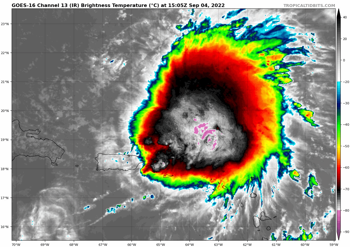
Fast Facts about Tropical Storm Earl…
10 am CDT Statistics:
Location: 19.5N/64.4W or about 85 miles to the north-northeast of St. Thomas.
Maximum Winds: 50 mph
Minimum Central Pressure: 999 MB/29.50 Inches
Forward Movement: NW-3 mp
Satellite imagery and radar loops indicate that Earl is likely strengthening as it passes just north of the Virgin Islands early this afternoon. Air Force reconnaissance is currently sampling the storm and has forund 50 knot flight level winds in the northwester quadrant, but the plane hasn not made it over to the stronger northeast quadrant yet. There is a marked increase in deep convection near and around the center of circulation and it seems that the storm is taking advantage of an environment that consists of less dry air as compared to just 24 hours ago.
As it moves further to the north in the coming days, it’ll find itself in a more favorable environment for strengthening. All indications are that Earl will very likely become a hurricane by about the middle part of this week and could peak at about Category 3 strength late this coming week when it passes very near or just east of Bermuda.
Earl is now moving to the west-northwest at a slower forward speed of about 5-8 mph or so. An opening in the ridge of high pressure over the western Atlantic has developed along about the 65 West Longitude line. This will likely lead to Earl to track to the northwest and then turn to the north beginning during Monday and Tuesday. The question then becomes how sharp will the turn to the northeast be. Track model consensus is pretty consistent in showing a sharp enough turn so that Earl misses Bermuda to the east late this coming week. Other guidance such as the European model forecasts that Earl could end up becoming a significant threat to Bermuda as a Category 3-plus hurricane on about Friday. It should be noted though that a majority of the GFS ensemble and European ensemble model members show a track to the northeast that keeps Earl safely to the east of Bermuda.
Given that Earl looks fairly likely to strengthen quite a bit in the coming days, I think it’ll end up being guided to the north and then northeast by that opening in the high pressure ridge. This means that a track safely to the east of Bermuda late this coming week seems to be most likely.
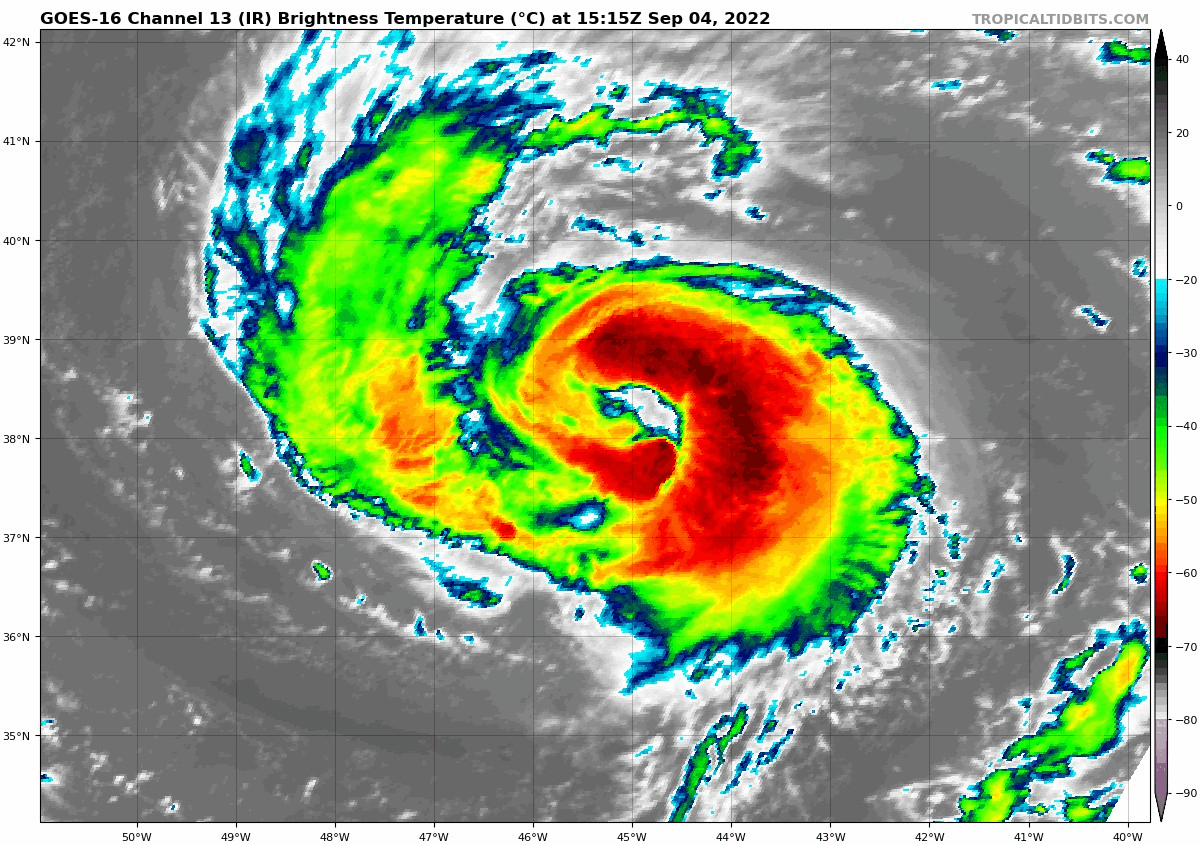
Fast Facts about Hurricane Danielle…
10 am CDT Statistics:
Location: 38.1N/45.3W or about 995 miles to the west northwest of the Azores
Maximum Winds: 80 mph
Minimum Central Pressure: 983 MB/29.03 Inches
Forward Movement: W-1 mph
Danielle continues to slowly strengthen. It should turn to the north later today and then to the northeast and be absorbed in the westerlies over the far North Atlantic. There were some indocations on the Eruo last night that it might make a job towards Bermuda in the 8-10 day time frame, but there is very low confidnce in that idea.
Category: Alabama's Weather, ALL POSTS, Tropical
About the Author (Author Profile)
Bill Murray is the President of The Weather Factory. He is the site's official weather historian and a weekend forecaster. He also anchors the site's severe weather coverage. Bill Murray is the proud holder of National Weather Association Digital Seal #0001 @wxhistorianSubscribe
If you enjoyed this article, subscribe to receive more just like it.


