

Severe Storms Threaten Alabama Through Tonight
**No afternoon Weather Briefing video today due to ongoing severe weather**
RADAR CHECK: Strong to severe storms continue to develop over the Tennessee Valley of North Alabama this afternoon… producing hail and strong winds in spots. A tornado warning is also in effect for parts of Washington County, in Southwest Alabama, at mid-afternoon.
Coverage of showers and storms will increase over the next few hours statewide. SPC has pushed the “moderate risk” (level 4/5) into Northwest Alabama, including parts of Franklin, Colbert, Marion, Winston, Lamar, Fayette, and Pickens counties. An “enhanced risk” (level 3/5) extends over to Huntsville, Gardendale, and Tuscaloosa. A “slight risk” (level 2/5) covers most of the rest of the state.
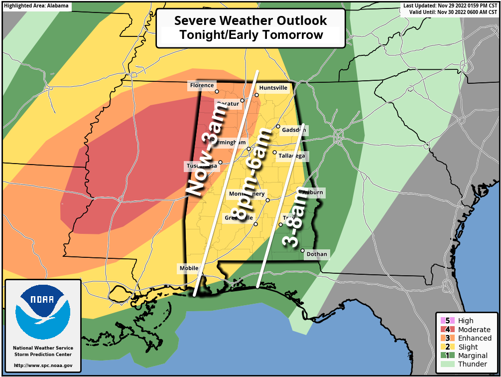
Here are some notes concerning tonight’s threat…
*The higher tornado threat is over the moderate and enhanced risk areas of West and Northwest Alabama, but a tornado can’t be ruled out in other parts of the state tonight. The tornado threat will begin to ramp up after 8:00 p.m. when surface based instability surges northward. The main concern before 8:00 p.m. comes from hail and strong straight line winds… but understand an isolated tornado can’t be ruled out before 8:00.
*Strong and favorably veered wind profiles will support several long-lived supercells tonight in the moderate and enhanced risk areas (Central Mississippi into Northwest Alabama). A few long-track strong tornadoes will be possible tonight as supercells mature and move northeastward.
*Rain amounts will average 1-2 inches, with locally heavier amounts. A flash flood warning has already been issued for parts of Franklin, Colbert, and Lauderdale counties in Northwest Alabama.
*Be sure you have a reliable way of hearing warnings tonight if they are needed. Never an outdoor siren. ?A NOAA Weather Radio is the baseline; have emergency alerts enabled on your phone. ?Have the ABC 33/40 weather app installed.
*In your safe place, have helmets for everyone.
*If you live in a mobile home, know the location of the nearest shelter or business that is open 2?4/7 and available as a shelter. Have transportation available. ?
*Follow the ABC 33/40 Facebook page so you can watch our coverage live on your phone. YouTube works as well… ?
http://facebook.com/abc3340
http://youtube.com/abc3340
*Don’t worry about severe weather risk levels or numbers, just be ready for severe storms tonight.
*Please don’t be anxious about tonight‘s weather… severe weather threats like this are common in Alabama between now and May. Get the warning, have a plan, and we will get through the night together just fine.
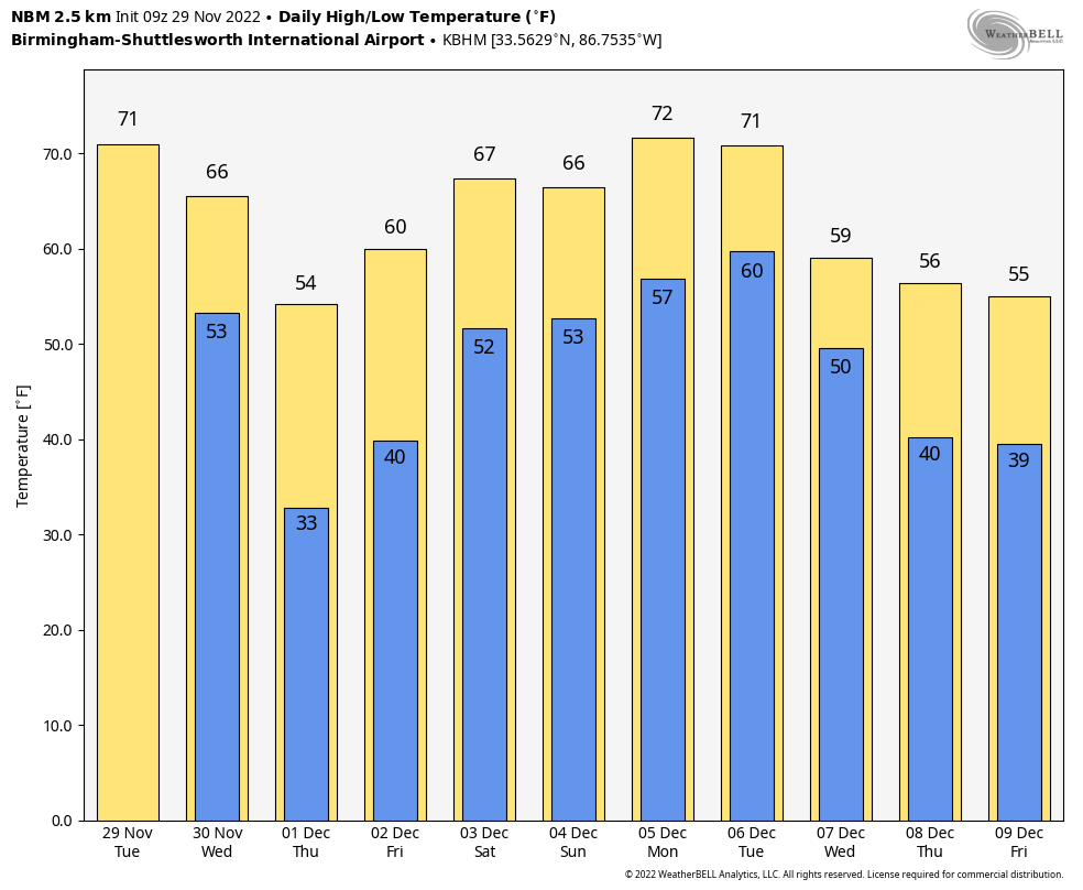
Look for a breezy and much cooler day tomorrow with temperatures falling through the 50s… the sky will gradually clear. We drop into the 27-32 degree range across North/Central Alabama by early Thursday morning. The weather will be dry Thursday and Friday with a good supply of sunshine both days; the high Thursday will be in the 50s, followed by 60s Friday.
THE WEEKEND: Showers are possible Saturday as a surface front pushes into the state. No risk of severe storms, probably very little thunder. Not a washout at all, but just be ready for some rain at times if you have an event outdoors. The high Saturday will be in the 65-70 degree range. Sunday’s forecast is a low confidence one due to model inconsistency, but the latest guidance suggests the front will stall out, meaning some risk of rain will continue through Sunday.
NEXT WEEK: We will mention a chance of showers Tuesday night and Wednesday with a cold front passing through, followed by cooler, drier air over the latter half of the week. Temperatures will reach the low 70s Monday and Tuesday, followed by low 60s Wednesday, and 50s Thursday and Friday. See the daily Weather Briefing video for maps, graphics, and more details.
ON THIS DATE IN 1991: A tornado struck southeast Springfield, Missouri, causing F4 damage. Shortly after touchdown, the tornado reached F3 intensity, approximately 3 miles north of the town of Nixa. While crossing Highway 65, the tornado picked up a truck and dropped it onto a frontage road, killing one passenger and injuring ten others. The tornado intensified to F4 strength as it moved through the Woodbridge and Natural Bridge Estates subdivisions where 15 homes were destroyed. Altogether, two people were killed and 64 others were injured.
ON THIS DATE IN 2016: Eleven tornadoes touched down across Alabama…one EF2 moved just under 10 miles from near Arley to Helicon in Winston County and ended two miles over the Cullman County line. The NWS survey determined the estimated maximum winds were near 130 mph.
BEACH FORECAST: Click here to see the AlabamaWx Beach Forecast Center page.
Look for the next Weather Briefing video here by 6:00 a.m. tomorrow…
Category: Alabama's Weather, ALL POSTS
About the Author (Author Profile)
James Spann is one of the most recognized and trusted television meteorologists in the industry. He holds the AMS CCM designation and television seals from the AMS and NWA. He is a past winner of the Broadcast Meteorologist of the Year from both professional organizations.Subscribe
If you enjoyed this article, subscribe to receive more just like it.


