

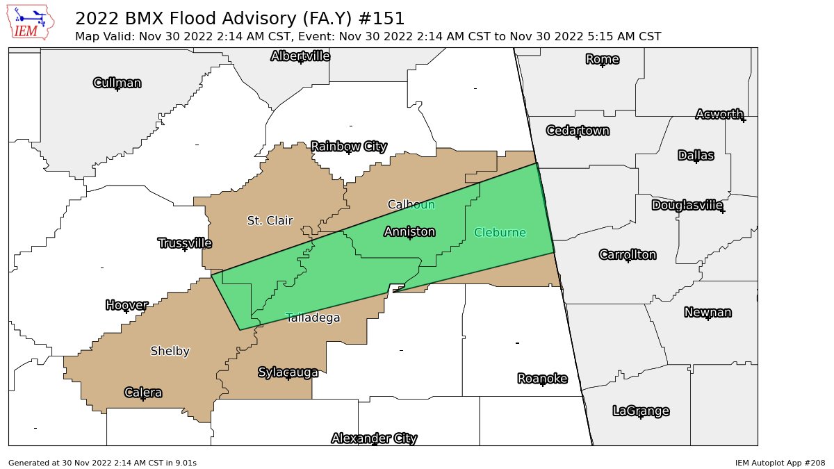
Areal Flood Advisory — Parts of Calhoun, Cleburne, Shelby, St. Clair, Talladega Co. Until 5:15 am
…FLOOD ADVISORY IN EFFECT UNTIL 515 AM CST EARLY THIS MORNING…
* WHAT…Urban and small stream flooding caused by excessive
rainfall is expected.
* WHERE…A portion of central Alabama, including the following
counties, Calhoun, Cleburne, Shelby, St. Clair and Talladega.
* WHEN…Until 515 AM CST.
* IMPACTS…Minor flooding in low-lying and poor drainage areas.
* ADDITIONAL DETAILS…
– At 214 AM CST, Doppler radar indicated heavy rain due to
thunderstorms. This will cause urban and small stream
flooding.
– Some locations that will experience flooding include…
Anniston, Oxford, Talladega, Pell City, Jacksonville, Leeds,
Heflin, Cobb Town, West End-Cobb Town, Saks, Fort McClellan,
Lincoln, Weaver, Vincent, Harpersville, Munford, Hobson City,
Fruithurst, Edwardsville and Anniston Regional Airport.
PRECAUTIONARY/PREPAREDNESS ACTIONS…
Turn around, don’t drown when encountering flooded roads. Most flood
deaths occur in vehicles.
Be especially cautious at night when it is harder to recognize the
dangers of flooding.
Category: Alabama's Weather, ALL POSTS
About the Author (Author Profile)
Scott Martin is an operational meteorologist, professional graphic artist, musician, husband, and father. Not only is Scott a member of the National Weather Association, but he is also the Central Alabama Chapter of the NWA president. Scott is also the co-founder of Racecast Weather, which provides forecasts for many racing series across the USA. He also supplies forecasts for the BassMaster Elite Series events including the BassMaster Classic.Subscribe
If you enjoyed this article, subscribe to receive more just like it.


