

Tuesday’s Weather Briefing Video — Rising Temperature’s This Week
TODAY: Up in the Tennessee Valley Region this morning, some patchy freezing fog has developed and may contribute to additional ice build up on those roadways. Ice will eventually begin to melt today as temperatures will be above freezing by the late morning hours. For Central Alabama, skies will eventually become mostly sunny today with highs reaching the mid 40s to the lower 50s across the area.
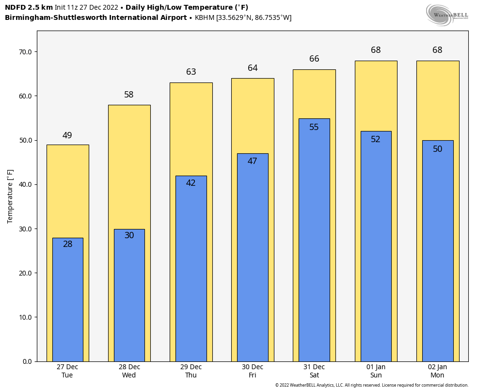
REST OF THE WORK WEEK: Wednesday will be another day with warmer temperatures as the ridge continues to pump in that warmer air. Afternoon highs in the mid 50s to the lower 60s with mostly sunny skies.
A frontal system will be getting its act together off to our west on Thursday that will bring an increase of clouds to the area. At this point, we look to stay dry with a mix of sun and clouds. Highs in the 60s.
The front gets closer to Central Alabama on Friday which will bring clouds and rain to the area. Rain will move in to the western parts by midday and slowly move eastward through the rest of the day. For now, it looks like the heavier rains will hold off until Saturday. Highs in the 60s.
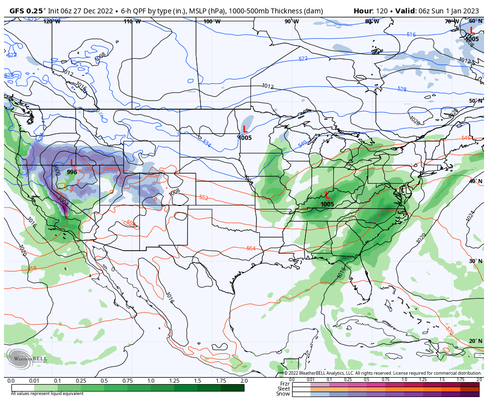
GFS valid at 12 am Sunday, January 1st, 2023.
NEW YEAR’S WEEKEND: It will be a wet end to 2022 as rain and some thunder will be likely throughout the day on Saturday. The front will continue moving through the area and rain will be heavy at times. 0.50 to 1.50 inches of rain will be possible. Much of the activity will be moving out by the evening and late night hours, but there will continue to be a chance of rain for the New Year’s celebrations at midnight. Highs in the lower 60s to the lower 70s.
After the shower chances end before sunrise, New Year’s Day looks to be very nice and mild across the area, as skies will mostly clear out, and we end up with mostly sunny skies. Afternoon highs in the mid 60s to the lower 70s.
Enjoy New Year’s Day, because it looks like the last dry day for a little while. Monday will start off dry, but showers will begin to move into the western parts of the area by the early evening. Once that occurs, rain chances will be with us through much of next week until late Friday night. Monday’s highs in the mid 60s to the lower 70s.
Category: Alabama's Weather, ALL POSTS, Weather Xtreme Videos, Winter Weather
About the Author (Author Profile)
Scott Martin is an operational meteorologist, professional graphic artist, musician, husband, and father. Not only is Scott a member of the National Weather Association, but he is also the Central Alabama Chapter of the NWA president. Scott is also the co-founder of Racecast Weather, which provides forecasts for many racing series across the USA. He also supplies forecasts for the BassMaster Elite Series events including the BassMaster Classic.Subscribe
If you enjoyed this article, subscribe to receive more just like it.


