

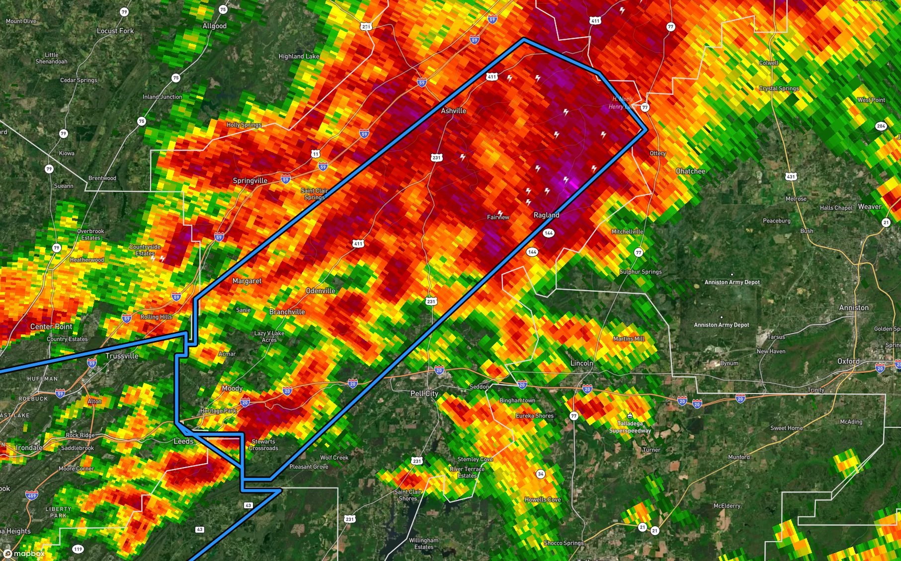
Flash Flood Warning for Portions of St. Clair Co. Until 3 am
The National Weather Service in Birmingham has issued a
* Flash Flood Warning for…
Central St. Clair County in central Alabama…
* Until 300 AM CST.
* At 1202 AM CST, Doppler radar indicated thunderstorms producing
heavy rain across the warned area. Flash flooding is ongoing or
expected to begin shortly.
HAZARD…Flash flooding caused by thunderstorms.
SOURCE…Radar.
IMPACT…Flash flooding of small creeks and streams, urban
areas, highways, streets and underpasses as well as
other poor drainage and low-lying areas.
* Some locations that will experience flash flooding include…
Leeds, Moody, Springville, Odenville, Margaret, Argo, Ashville,
Ragland, Ohatchee, Branchville, Bald Rock, Neely Henry Lake,
Wattsville, Chula Vista and Camp Winnataska.
PRECAUTIONARY/PREPAREDNESS ACTIONS…
Turn around, don’t drown when encountering flooded roads. Most flood
deaths occur in vehicles.
Be especially cautious at night when it is harder to recognize the
dangers of flooding.
Be aware of your surroundings and do not drive on flooded roads.
Category: Alabama's Weather, ALL POSTS
About the Author (Author Profile)
Scott Martin is an operational meteorologist, professional graphic artist, musician, husband, and father. Not only is Scott a member of the National Weather Association, but he is also the Central Alabama Chapter of the NWA president. Scott is also the co-founder of Racecast Weather, which provides forecasts for many racing series across the USA. He also supplies forecasts for the BassMaster Elite Series events including the BassMaster Classic.Subscribe
If you enjoyed this article, subscribe to receive more just like it.


