

Nice Warm-Up Today; Storms Return Thursday
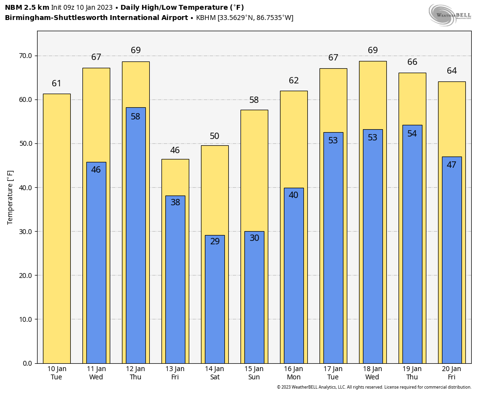
COLD START, MILD AFTERNOON: Colder pockets across North Alabama are in the 20s early this morning, but we expect a nice warm-up today with temperatures rising into the 60s in most places this afternoon with a good supply of sunshine. Some South Alabama communities will reach 70 today. Most of the state will be dry and mild tomorrow, but a few showers could form near the Gulf Coast as moisture levels begin to rise. Highs tomorrow will be in the 67-73 degree range.
STORMS RETURN THURSDAY: A cold front will push a band of showers and thunderstorms into Alabama Thursday. SPC has much of the state in a “slight risk” (level 2/5) of severe storms…
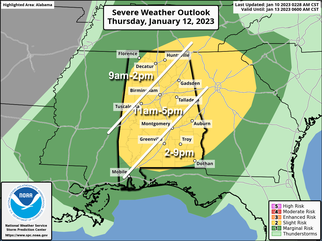
Storms will enter Northwest Alabama Thursday morning, and will progress through the state during the day. The storm mode is expected to be linear, meaning the main threat will come from strong winds. A brief tornado can’t be totally ruled out, but isn’t especially likely. The highest chance of a brief tornado will come Thursday afternoon in areas east and south of Montgomery. Rain amounts of 1/2 to 1 inch are expected, and the high will be in the 65-71 degree range.
FRIDAY AND THE WEEKEND: Much colder air invades the state Friday… temperatures hold in the 40s over the northern counties with a chilly north breeze. A few snow flurries are possible Friday morning across the northern third of the state, but no accumulation or impact is expected. The weekend will feature sunny cool days and clear cold nights. Highs will be in the 50s Saturday, followed by 60s Sunday. Morning lows will be in the 25-35 degree range. Colder spots could see low 20s Saturday morning.
NEXT WEEK: Another wave will bring a chance of showers and storms to the state Monday night and Tuesday, followed by another chance of wet weather by Thursday or Friday. Highs will be mostly in the 60s through the week… See the daily Weather Briefing video for maps, graphics, and more details.
ON THIS DATE IN 1975: An F3 tornado moved through St. Clair county, producing major damage at Pell City and Ragland. One person was killed, 60 people were
injured. Along the path at least 54 homes were destroyed and 307 homes were damaged. 15 trailers were destroyed and 27 businesses were damaged or destroyed.
ON THIS DATE IN 1982: Bitterly cold weather was found across Illinois. Of the 109 weather reporting stations in the state, 48 of those reported lows of 20 degrees below zero or colder. Some of the most frigid temperatures included 27 below zero at Rockford, 26 below zero at Chicago, and 25 below zero at Kankakee and Peoria. The Freezer Bowl was played between the Cincinnati Bengals and the San Diego Chargers in bitterly cold wind chills. The air temperature was -9F, but the wind chill, factoring in a sustained wind of 27 mph, was -37F.
BEACH FORECAST: Click here to see the AlabamaWx Beach Forecast Center page.
Look for the next Weather Briefing video here by 3:00 this afternoon… enjoy the day!
Category: Alabama's Weather, ALL POSTS, Weather Xtreme Videos
About the Author (Author Profile)
James Spann is one of the most recognized and trusted television meteorologists in the industry. He holds the AMS CCM designation and television seals from the AMS and NWA. He is a past winner of the Broadcast Meteorologist of the Year from both professional organizations.Subscribe
If you enjoyed this article, subscribe to receive more just like it.


