

Windy, Stormy Day Tomorrow; Much Colder Friday
THIS AFTERNOON: The sky is mostly sunny across South Alabama this afternoon, where temperatures are now in the mid 70s. Clouds are keeping temperatures mostly in the 60s over the northern half of the state. We note a few isolated showers near the Gulf Coast, but the weather is dry elsewhere. The sky will be mostly cloudy tonight with a low in the 55-62 degree range.
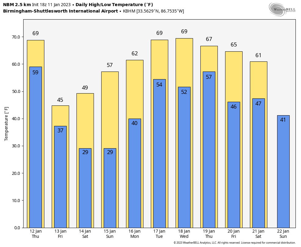
TOMORROW: A cold front will push a band of showers and thunderstorms into Alabama tomorrow; all of the state is in either a level 1 or level 2 (out of 5) severe weather threat, as defined by SPC…
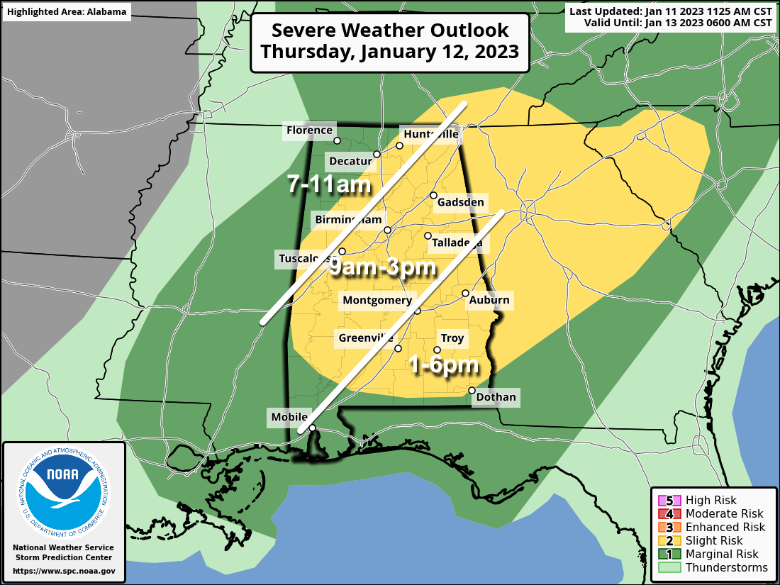
The line of storms will form over the northwest part of the state early in the day, around 7-8 a.m…. then it passes southward through the day. The primary threat will come from strong straight line winds, although a brief, isolated tornado can’t be totally ruled out. Highest chance of a brief tornado will come tomorrow afternoon across Southeast Alabama, where instability values will be higher. Rain amounts should be generally around 1/2 inch, and flooding is not expected.
We also note that tomorrow will be a windy day away from thunderstorms… gradient winds will gust to 35 mph at times. A wind advisory will most likely be needed for most of the state.
FRIDAY AND THE WEEKEND: Friday will be breezy and much colder. With a partly sunny sky, temperatures won’t get out of the 40s over North Alabama. And, a few morning snow flurries are possible across the northern counties, but there won’t be any impact or accumulation. Early morning emperatures will be well below freezing over much of the state over the weekend. The sky will be sunny both days… the high Saturday will be in the 40s and 50s, followed by 50s and 60s Sunday.
NEXT WEEK: The weather looks rather unsettled with multiple rounds of rain and thunderstorms likely… the first one coming Monday night into Tuesday morning. Highs will be mostly in the 60s; See the daily Weather Briefing video for maps, graphics, and more details.
ON THIS DATE IN 1898: An estimated F4 tornado struck the city of Fort Smith, Arkansas, just before midnight. The tornado, which touched down about 100 miles southwest of town, killed 55 people and injured 113 others along its track.
ON THIS DATE IN 1918: A powerful area of low pressure brought snow and bitterly cold temperatures to the Deep South. Birmingham picked up an inch of snow. In far Southeast Alabama, an estimated F3 tornado virtually damaged every building in the town of Webb. The tornado leveled one rural school, killing one teacher and seven students.
BEACH FORECAST: Click here to see the AlabamaWx Beach Forecast Center page.
Look for the next Weather Briefing video here by 6:00 a.m. tomorrow…
Category: Alabama's Weather, ALL POSTS, Weather Xtreme Videos
About the Author (Author Profile)
James Spann is one of the most recognized and trusted television meteorologists in the industry. He holds the AMS CCM designation and television seals from the AMS and NWA. He is a past winner of the Broadcast Meteorologist of the Year from both professional organizations.Subscribe
If you enjoyed this article, subscribe to receive more just like it.


