

NEW Severe Thunderstorm Warning for Portions of Marshall, Madison, Limestone, and Morgan Counties until 930 am
This warning is for the storm that came out of Winston County earlier and produced confirmed tornado damage near Delmar.
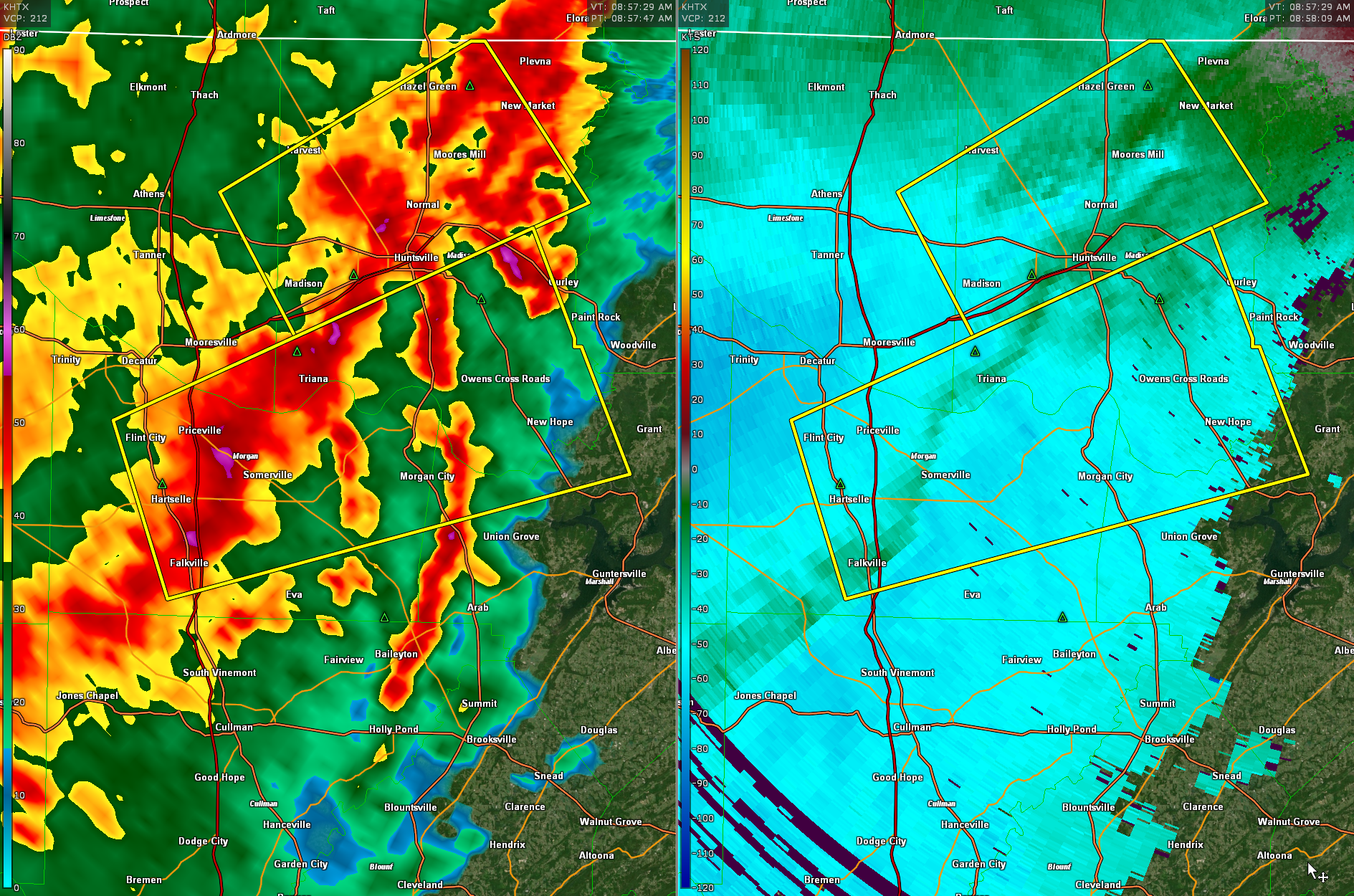
It is the southern of the two severe thunderstorm warning polygons.
The National Weather Service in Huntsville Alabama has issued a
* Severe Thunderstorm Warning for…
Northwestern Marshall County in northeastern Alabama…
Southern Madison County in north central Alabama…
Southeastern Limestone County in north central Alabama…
Central Morgan County in north central Alabama…
* Until 930 AM CST.
* At 854 AM CST, a severe thunderstorm was located near Hartselle,
moving east at 55 mph.
HAZARD…60 mph wind gusts and quarter size hail.
SOURCE…Radar indicated.
IMPACT…Hail damage to vehicles is expected. Expect wind damage
to roofs, siding, and trees.
* Locations impacted include…
Southern Huntsville, Decatur, Hartselle, Redstone Arsenal,
Priceville, Owens Cross Roads, Falkville, Gurley, Triana and
Marshall Space Flight Center.
PRECAUTIONARY/PREPAREDNESS ACTIONS…
For your protection move to an interior room on the lowest floor of a
building.
A Tornado Watch remains in effect until 100 PM CST for north central,
northeastern and northwestern Alabama…and Middle Tennessee.
Category: Alabama's Weather, ALL POSTS, Severe Weather
About the Author (Author Profile)
Bill Murray is the President of The Weather Factory. He is the site's official weather historian and a weekend forecaster. He also anchors the site's severe weather coverage. Bill Murray is the proud holder of National Weather Association Digital Seal #0001 @wxhistorianSubscribe
If you enjoyed this article, subscribe to receive more just like it.


