

Severe Threat Has Ended for Today; Last Few Counties in Tornado Watch Cancelled
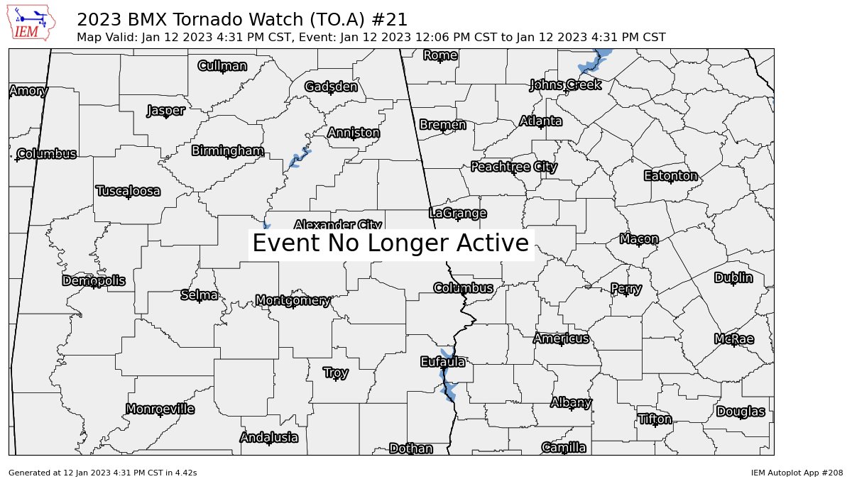
NWS Birmingham has cancelled the Tornado Watch for Barbour, Bullock, Lee, Macon, Pike, Russell counties in Central Alabama as the threat for severe weather has come to an end.
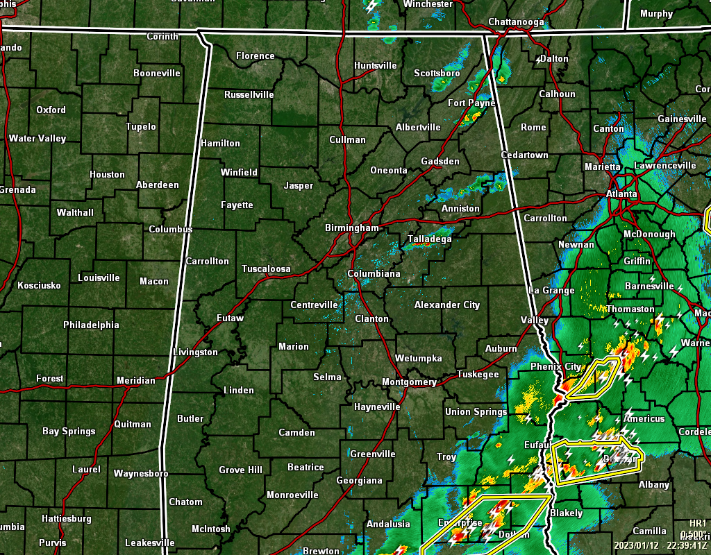
At 4:39 pm, we still have a few scattered showers and storms over the northeast quarter of the area, while the main line of storms continue to exit the southeastern parts of Central Alabama. None of the remaining cells in North/Central Alabama are strong, but we’ll be dealing with gusty winds for a little while longer.
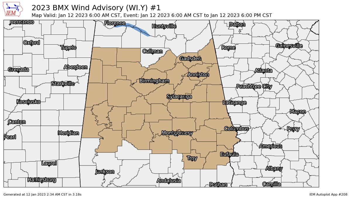
A Wind Advisory remains in effect to 6 pm this evening for all of Central Alabama as the pressure gradient remains tight. Sustained winds of 10-20 mph along with gusts of 30-40 mph can be expected through the end of the advisory period.
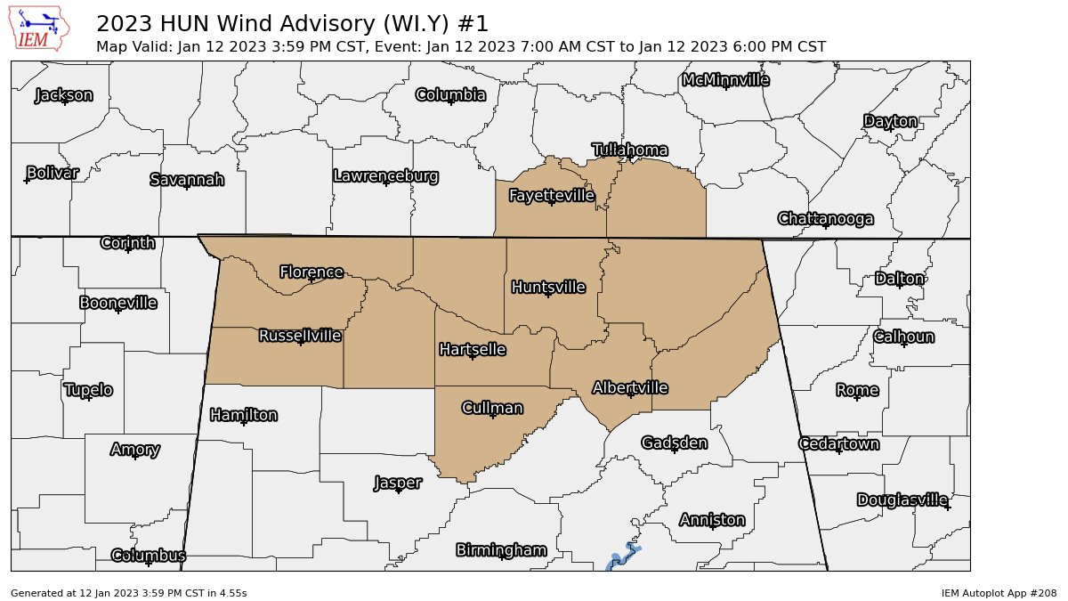
For those counties in the Tennessee Valley, it’s the same story for you. A Wind Advisory continues until 6 pm tonight.
Here are some Tweets of damage from around the area through Spann’s Twitter feed:
More storm damage from Selma… photos from Bryant Hornsby pic.twitter.com/iCYU6oopQX
— James Spann (@spann) January 12, 2023
NEW: Curfew in effect in the City of Eutaw from 7pm to 7am. Streets are still impassable due to trees and power lines down. @abc3340 @spann #alwx pic.twitter.com/QZDm2Xkv0d
— Stephen Quinn (@StephenQ3340) January 12, 2023
@Spann @JoshWeather @WSFA_Amanda at hwy 143 at county rd 68 east in Marbury pic.twitter.com/mDixJWAPFF
— Cody Oates (@CodyBlakeOates) January 12, 2023
Damage in Coosa County south of Rockford… photos from Joseph Robinson pic.twitter.com/GLcTFRvboN
— James Spann (@spann) January 12, 2023
Tornado damage at Marbury… on Tram Road. Photos from Tiffany McCloud pic.twitter.com/myBv5MY1EQ
— James Spann (@spann) January 12, 2023
Crosspoint Church… West Selma, along AL 22 one mile west of the country club… photos from @mills_on_the_fly (IG) pic.twitter.com/tCyZ4aXhXP
— James Spann (@spann) January 12, 2023
Unfortunately, there are way too many Tweets of damage to show in one post due to today’s severe storms. Please say a prayer for those affected. Please do not drive through these areas to see the damage. If you would like to help, reach out to those communities and see how you can safely do that.
Category: Alabama's Weather, ALL POSTS, Severe Weather
About the Author (Author Profile)
Scott Martin is an operational meteorologist, professional graphic artist, musician, husband, and father. Not only is Scott a member of the National Weather Association, but he is also the Central Alabama Chapter of the NWA president. Scott is also the co-founder of Racecast Weather, which provides forecasts for many racing series across the USA. He also supplies forecasts for the BassMaster Elite Series events including the BassMaster Classic.Subscribe
If you enjoyed this article, subscribe to receive more just like it.


