

Strong Storms Late Tonight; Dry Air Returns Tomorrow
FOGGY START: A dense fog advisory is in effect for all 67 Alabama counties early this morning; visibility is down to just a fraction of a mile in spots. The fog will dissipate by mid-morning.
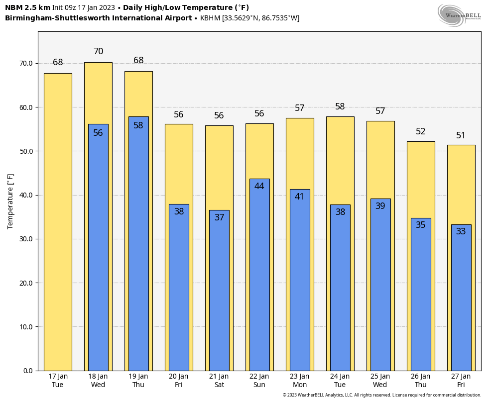
We are projecting a high in the 70-75 degree range over most of Alabama this afternoon. This is almost twenty degrees above average, and not far from record levels. The record high for Birmingham today (January 18) is 76, set in 1929. The sky will feature more clouds than sun with just a few isolated showers this afternoon.
TONIGHT: A band of strong storms will push into Alabama late tonight ahead of a cold front. SPC maintains a low end, “marginal risk” (level 1/5) of severe thunderstorms west of a line from Fort Payne to Calera to Thomasville in their day one outlook, which is valid through 6:00 a.m. tomorrow
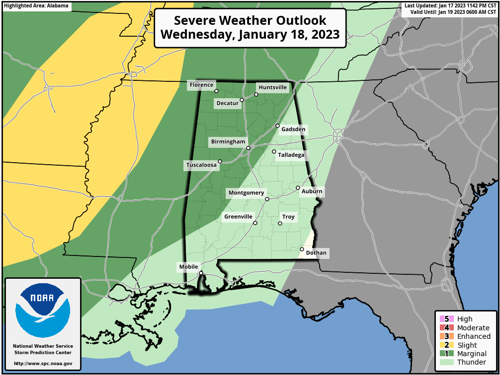
The line of storms will enter the northwest corner of the state around 11:00 tonight… it will roll through during the pre-dawn hours with gusty winds. A brief, isolated tornado can’t be totally ruled out, but is very unlikely. There just isn’t any surface based instability and the main dynamic support will be lifting away from the Deep South. Storms will weaken by daybreak, and they should stay below severe limits tomorrow morning as they push into Southeast Alabama. SPC has removed the “marginal risk” in their outlook for tomorrow, valid after 6:00 a.m.
The sky will be mostly sunny tomorrow as dry air returns to the state with a high in the 60s.
FRIDAY AND THE WEEKEND: Friday will be a sunny, cooler day with a high in the 50s over North Alabama, with 60s to the south. Clouds return Saturday, and rain will begin over the southern counties of the state during the morning hours. Then, rain will be widespread across Alabama late Saturday afternoon through a decent part of the day Sunday. Rain amounts will be around one inch over the weekend, and there is no risk of severe storms and probably little thunder. Expect highs generally in the 50s both days.
NEXT WEEK: The weather will be dry Monday, but another disturbance will bring rain back to the state in the Tuesday/Wednesday time frame. Dry air returns Thursday and Friday, and temperatures will be seasonal through the week with highs mostly in the 50s. See the daily Weather Briefing video for maps, graphics, and more details.
ON THIS DATE IN 1971: A warm Santa Ana condition brought a 95 degree reading to Los Angeles, the highest January temperature on record. It was 95 degrees in Palm Springs, the highest temperature on record for January as well.
BEACH FORECAST: Click here to see the AlabamaWx Beach Forecast Center page.
Look for the next Weather Briefing video here by 3:00 this afternoon… enjoy the day!
Category: ALL POSTS
About the Author (Author Profile)
James Spann is one of the most recognized and trusted television meteorologists in the industry. He holds the AMS CCM designation and television seals from the AMS and NWA. He is a past winner of the Broadcast Meteorologist of the Year from both professional organizations.Subscribe
If you enjoyed this article, subscribe to receive more just like it.


