

Late Night Check on Our Weather Situation
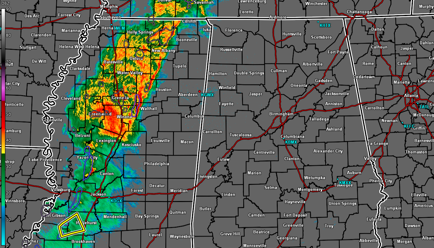
RADAR CHECK: At 8:57 pm, a line of rain and thunderstorms was pushing eastward through the central portions of Mississippi and is headed toward Central Alabama. At this point, there is only one severe thunderstorm warning in effect for portions of Claiborne, Jefferson, and Copiah counties in southwestern Mississippi for a cell that has the potential for damaging wind gusts. Other than that, just moderate to heavy rainfall.
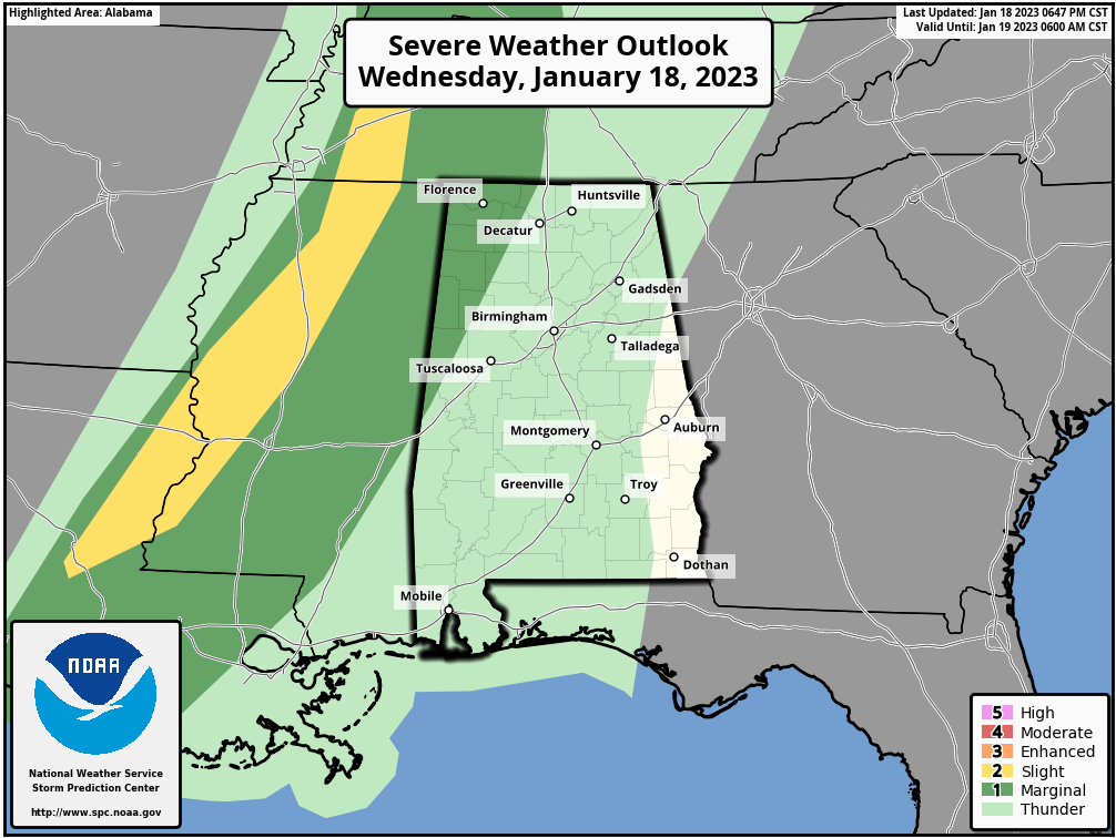
The Storm Prediction Center continues a Marginal Risk of severe storms for the extreme west and northwestern parts of the area through the remainder of tonight and into the pre-dawn hours on Thursday morning. The main threat with any storm that becomes severe will be from damaging winds, but some hail and a brief tornado can’t be ruled out.
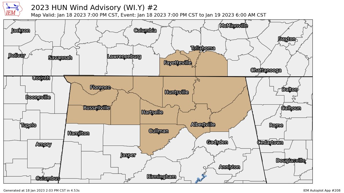
A Wind Advisory continues for all counties in the Tennessee Valley (Colbert, Cullman, DeKalb, Franklin, Jackson, Lauderdale, Lawrence, Limestone, Madison, Marshall, Morgan) and for Blount, Cherokee, Etowah, Fayette, Lamar, Marion, Walker, Winston counties in the northern parts of Central Alabama until 6 am Thursday morning. Gusty winds up to 35 mph could blow around unsecured objects. Tree limbs could be blown down and a few power outages may result. Use extra caution when driving, especially if operating a high
profile vehicle.
Category: Alabama's Weather, ALL POSTS, Severe Weather
About the Author (Author Profile)
Scott Martin is an operational meteorologist, professional graphic artist, musician, husband, and father. Not only is Scott a member of the National Weather Association, but he is also the Central Alabama Chapter of the NWA president. Scott is also the co-founder of Racecast Weather, which provides forecasts for many racing series across the USA. He also supplies forecasts for the BassMaster Elite Series events including the BassMaster Classic.Subscribe
If you enjoyed this article, subscribe to receive more just like it.


