

Just Before 8 pm Update — Rain Has Crossed Over the Alabama/Mississippi State Line
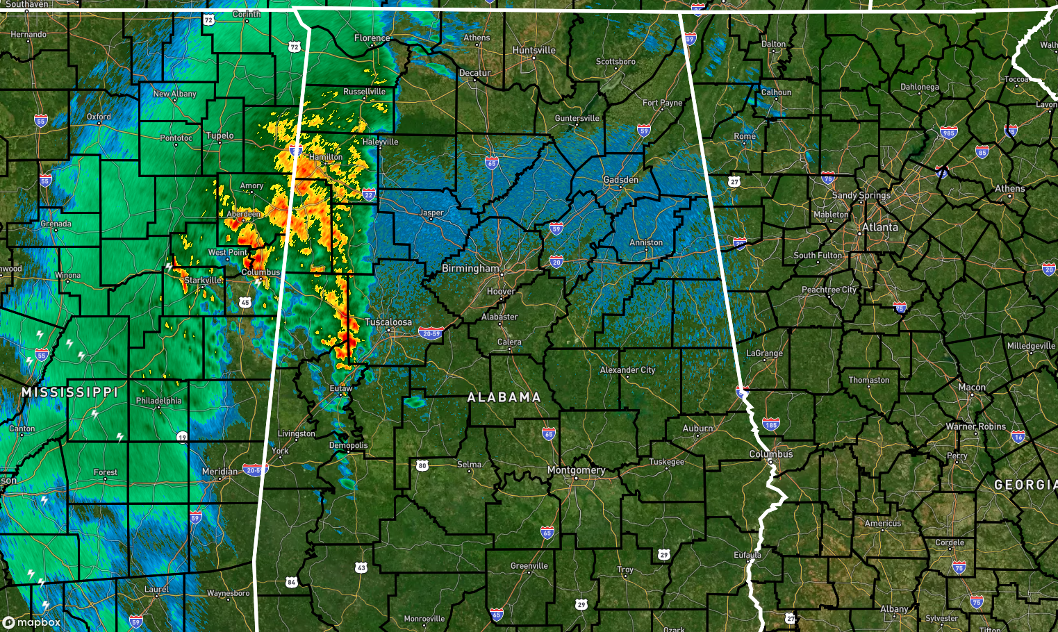
RADAR CHECK: At 7:49 pm, rain has crossed over the state line and now stretched from just south of Eutaw all the way north through Florence and into Tennessee. At this point, while some of the rainfall is heavy, none of these cells are producing any thunder. Winds have started to pick up, but they are nowhere near the Wind Advisory criteria for now. That will change later on, unfortunately.
 .
.
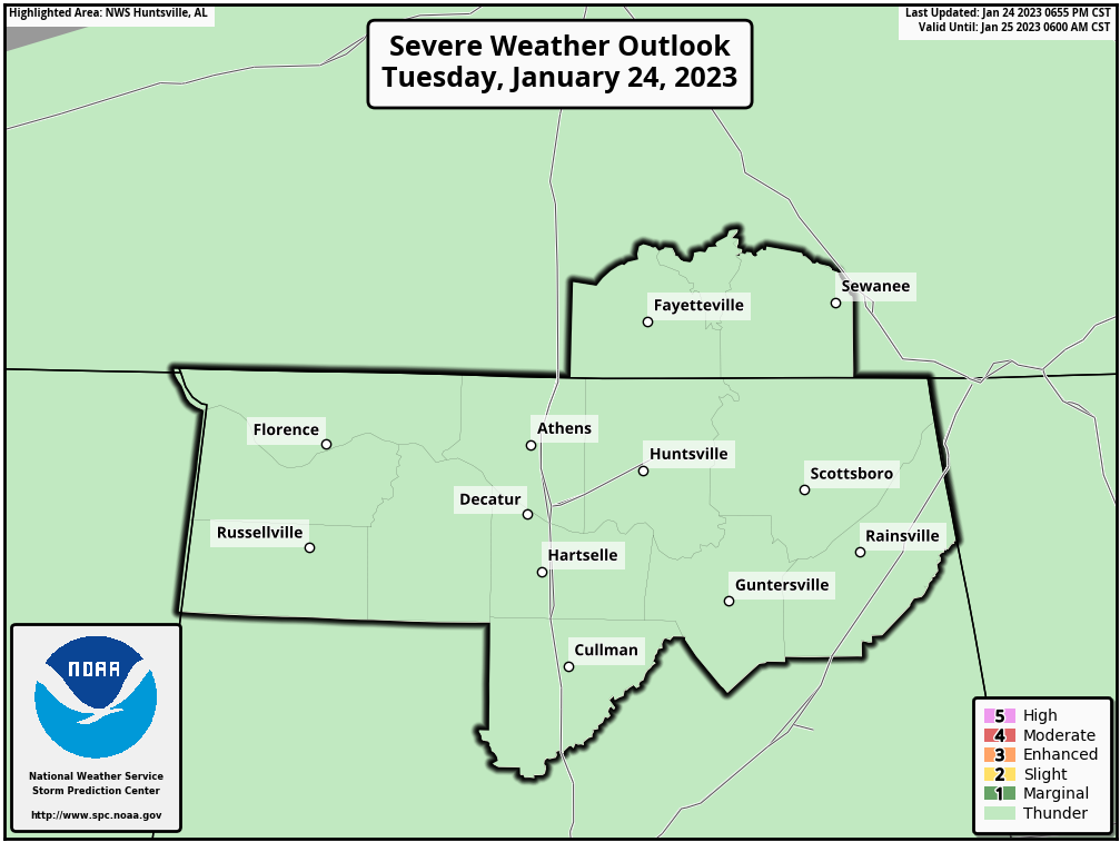
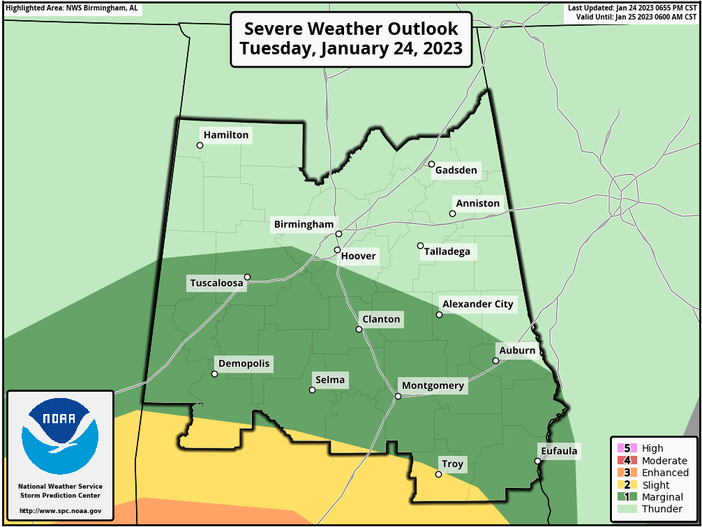
The latest update from the Storm Prediction Center continues no severe risk for the Tennessee Valley and for much of the northern half of Central Alabama. A Marginal Risk is up for locations south of a line from roughly Reform to Helena to Smiths Station. Only the extreme southern parts of Central Alabama is in a Slight Risk, mainly south of a line from just north of Sweet Water to Fort Deposit to just north of Troy.
The window for the main threat of severe storms for those in the risk locations will start around midnight tonight in the west and should come to an end by 7 am Wednesday morning in the east. The main threat will be from damaging winds up to 60 mph, but a brief tornado or two cannot be ruled out.
As long as there is a threat, I’ll be up with you through the late-night and overnight hours, especially if a watch is issued.
Category: Alabama's Weather, ALL POSTS, Severe Weather
About the Author (Author Profile)
Scott Martin is an operational meteorologist, professional graphic artist, musician, husband, and father. Not only is Scott a member of the National Weather Association, but he is also the Central Alabama Chapter of the NWA president. Scott is also the co-founder of Racecast Weather, which provides forecasts for many racing series across the USA. He also supplies forecasts for the BassMaster Elite Series events including the BassMaster Classic.Subscribe
If you enjoyed this article, subscribe to receive more just like it.


