

Midday Nowcast: Rain and Storms Return Tonight
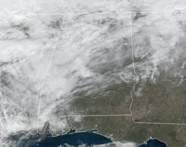
It is a warm and breezy day with highs surging into the 70s statewide. An approaching cold front will being rain and storms back to Alabama late tonight. The SPC maintains a “marginal risk” (level 1/5) of severe thunderstorms for the western half of the state tonight, with higher severe weather threats to our west in Mississippi, Louisiana, and Arkansas.
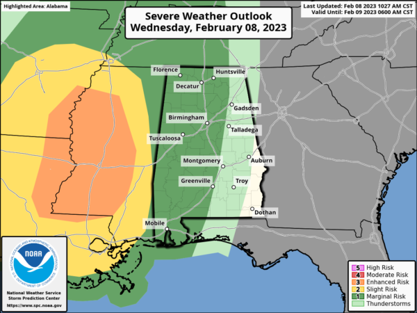
Not much change in the timing as the main batch of rain and storms will arrive after midnight tonight, but with very little surface based instability, the severe weather threat is low, but still we will be watching things carefully. As the storms move through, they could produce gusty winds, and brief, isolated tornado can’t be totally ruled out.
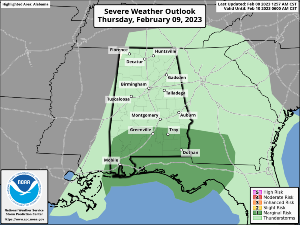
The main issue late tonight will be gradient winds (not related to thunderstorms)…winds could gust to 35/40 mph in spots ahead of the big mass of rain. A wind advisory has been issued for the northern half of the state. Rain will gradually diminish over North/Central Alabama tomorrow morning, but will continue over the southern counties. SPC maintains a “marginal risk” over South Alabama for storms tomorrow afternoon that might produce strong, gusty winds.
Temperatures will fall into the 50s over North Alabama tomorrow, with 60s to the south. Friday will be dry for must of the state, although rain will remain possible across the southern sections of the state. The high Friday will be mostly in the 60s.
WEEKEND WEATHER: An upper low will move slowly through the state Friday night and Saturday with periods of light rain likely. We will have to watch this carefully, in weather we have a saying, “Upper-level low, weather person’s whoa.” As the low swings through the state, the cold air aloft associated with it, there will likely be some areas of snow mix Friday night or Saturday morning over portions of North Alabama. If this happens there won’t be any impact or accumulation as surface temperatures will be too warm, but it could certainly make for some excitement for some. The high Saturday will be in the 50s. Then, on Sunday, the sky becomes sunny with highs in the 50s and 60s.
NEXT WEEK: The week starts off dry, but the models suggest we will deal with another round of rain and storms again around midweek, likely Tuesday night into early Wednesday and possible into Thursday. Highs will be mostly in the 60s through the week; still no sign of any bitterly cold air for the Deep South for the next 10-15 days.
BEACH FORECAST CENTER: Get the latest weather and rip current forecasts for the beaches from Fort Morgan to Panama City on our Beach Forecast Center page. There, you can select the forecast of the region that you are interested in visiting.
WORLD TEMPERATURE EXTREMES: Over the last 24 hours, the highest observation outside the U.S. was 109.2F at Escuela Mirasol-Puerto Montt, Chile. The lowest observation was -67.4F at Ojmjakon, Russia.
CONTIGUOUS TEMPERATURE EXTREMES: Over the last 24 hours, the highest observation was 90F at Falcon Lake, TX. The lowest observation was -16F at Gunnison County, CO.
Category: Alabama's Weather, ALL POSTS
About the Author (Author Profile)
Macon, Georgia Television Chief Meteorologist, Birmingham native, and long time Contributor on AlabamaWX. Stormchaser. I did not choose Weather, it chose Me. College Football Fanatic. @Ryan_StinnetSubscribe
If you enjoyed this article, subscribe to receive more just like it.


