

Saturday’s Weather Briefing – Rain Creeps In Late Today; Strong to Severe Storms Possible on Sunday
THIS WEEKEND
Today will start off with mostly sunny skies, but through the afternoon hours, clouds will begin to increase from the west as a cold front will be pushing in our direction. Showers will start to move into the area by late afternoon and through the evening and nighttime hours. Highest rain chances will be along and north of the I-20 corridor. Highs in the lower 60s to the lower 70s.
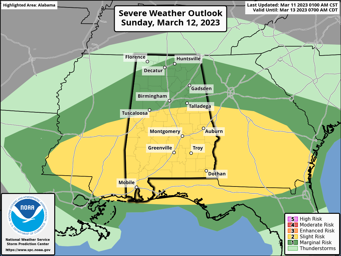
Sunday will start off with rain and thunderstorms across a good bit of Central Alabama as the cold front will begin to make its way into and eventually through the area. Storms during the afternoon and evening hours may pack a punch with damaging winds and hail. SPC has a Slight Risk up for locations south of a line from just north of Geiger to Alabaster to just north of Wedowee, while nearly the rest of the state north of this is in a Marginal Risk. The main severe threat window will be from noon in the northwest and coming to an end around 7 pm in the southeast. Highs in the lower 60s to the mid 70s.
NEXT WEEK
Cooler and drier air will be the story across the area for the first half of next week after the cold front moves through. Monday will be sunny and breezy, with highs in the lower 50s to the mid 60s. Tuesday will start off chilly, with widespread frost possible, but we’ll see sunny skies and highs in the lower 50s to the lower 60s. Same story on Wednesday morning, with frost possible, but ridging starts to move in, warming our highs into the upper 50s to the upper 60s.
Warm air advection continues to pull in warmer air from the south as we see our next system heading in our direction on Thursday. Skies will be sunny during the daylight hours, with clouds increasing late. Highs in the upper 60s to the mid 70s.
And at the end of the forecast period on Friday… A cold front will move into and through the area bringing rain and maybe a clap of thunder or two, but at this point, instability rates look to be very low and strong storms do not look to be possible. Highs in the lower 60s to the upper 70s.
Category: Alabama's Weather, ALL POSTS, Severe Weather, Weather Xtreme Videos
About the Author (Author Profile)
Scott Martin is an operational meteorologist, professional graphic artist, musician, husband, and father. Not only is Scott a member of the National Weather Association, but he is also the Central Alabama Chapter of the NWA president. Scott is also the co-founder of Racecast Weather, which provides forecasts for many racing series across the USA. He also supplies forecasts for the BassMaster Elite Series events including the BassMaster Classic.Subscribe
If you enjoyed this article, subscribe to receive more just like it.


