

EXPIRED Tornado Possible Tag Added; Severe Thunderstorm Warning for Parts of Tallapoosa County until 845 am
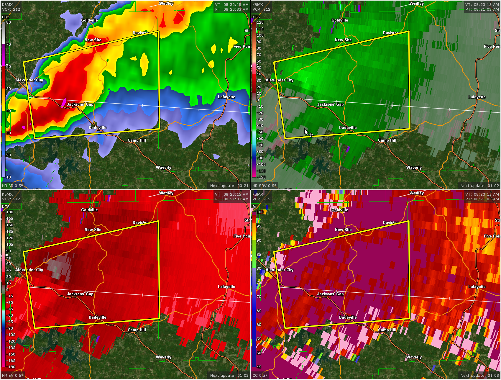
The NWS in Birmingham has added a TORNADO POSSIBLE tag to the severe thunderstorm warning for Tallapoosa County. The strongest part of the storm is near Jacksons’s Gap along Highway 280. It is sweeping toward Dadeville and Camp Hill in Tallapoosa County.
Damaging winds and a tornado are possible. Be in your safe place as this thunderstorm approaches you location.
ORIGINAL POST
The National Weather Service in Birmingham has issued a
* Severe Thunderstorm Warning for…
Northern Tallapoosa County in east central Alabama…
* Until 845 AM CDT.
* At 821 AM CDT, a severe thunderstorm was located over Northern Lake
Martin, or near Alexander City, moving east at 30 mph.
HAZARD…60 mph wind gusts and penny size hail.
SOURCE…Radar indicated.
IMPACT…Expect damage to roofs, siding, and trees.
* Locations impacted include…
Alexander City, Dadeville, Jacksons’ Gap, New Site, Hillabee Creek,
Northern Lake Martin, Wind Creek State Park, Eastern Lake Martin,
Daviston, Horseshoe Bend National Military Park, Dare Park, Eagle
Creek and Horseshoe Bend.
PRECAUTIONARY/PREPAREDNESS ACTIONS…
For your protection move to an interior room on the lowest floor of a
building.
Category: Alabama's Weather, ALL POSTS, Severe Weather
About the Author (Author Profile)
Bill Murray is the President of The Weather Factory. He is the site's official weather historian and a weekend forecaster. He also anchors the site's severe weather coverage. Bill Murray is the proud holder of National Weather Association Digital Seal #0001 @wxhistorianSubscribe
If you enjoyed this article, subscribe to receive more just like it.


