

EXPIRED Severe T-Storm Warning — Parts of Clay, Coosa, Talladega Co. Until 6:15 am
The National Weather Service in Birmingham has issued a
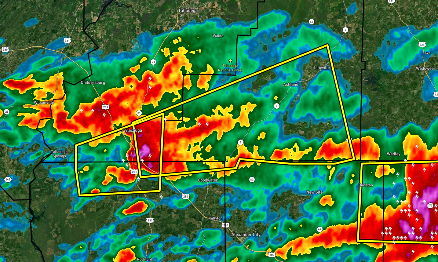
* Severe Thunderstorm Warning for…
South central Talladega County in east central Alabama…
Northeastern Coosa County in east central Alabama…
Southern Clay County in east central Alabama…
* Until 615 AM CDT.
* At 522 AM CDT, a severe thunderstorm was located near Stewartville,
moving east at 45 mph.
HAZARD…Ping pong ball size hail and 60 mph wind gusts.
SOURCE…Radar indicated.
IMPACT…People and animals outdoors will be injured. Expect hail
damage to roofs, siding, windows, and vehicles. Expect
wind damage to roofs, siding, and trees.
* Locations impacted include…
Sylacauga, Lineville, Ashland, Parkdale, Cleveland Crossroads,
Overbrook, Hollins, Roselle, Millerville, Mellow Valley and Mignon.
PRECAUTIONARY/PREPAREDNESS ACTIONS…
For your protection move to an interior room on the lowest floor of a
building.
Category: Alabama's Weather, ALL POSTS, Severe Weather
About the Author (Author Profile)
Scott Martin is an operational meteorologist, professional graphic artist, musician, husband, and father. Not only is Scott a member of the National Weather Association, but he is also the Central Alabama Chapter of the NWA president. Scott is also the co-founder of Racecast Weather, which provides forecasts for many racing series across the USA. He also supplies forecasts for the BassMaster Elite Series events including the BassMaster Classic.Subscribe
If you enjoyed this article, subscribe to receive more just like it.


