

Most Of Alabama Dry Tomorrow; Showers Return Thursday
BLUE SKY: We have a cloudless sky over the northern half of Alabama this afternoon with temperatures in the 70s. Clouds are over the Gulf Coast region in association with a broad surface low over the Louisiana coast; a few isolated showers are over Mobile and Baldwin counties. Fair weather continues tonight for the northern 2/3 of the state with lows in the 45-55 degree range. Clouds linger over South Alabama.
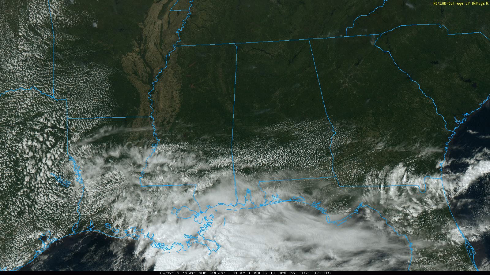
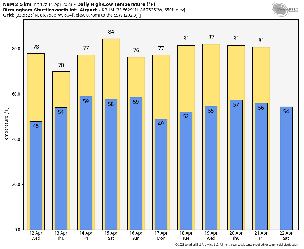
The weather tomorrow won’t change much; lots of sun for North/Central Alabama… showers are possible over the southwest corner of the state. Highs will remain in the 70s.
THURSDAY/FRIDAY: Showers are possible statewide Thursday as a broad surface low lifts northward from the Gulf of Mexico. SPC maintains a low end “marginal risk” of severe thunderstorms for the southeast counties of the state… for areas east of a line from Roanoke to Prattville to Atmore.
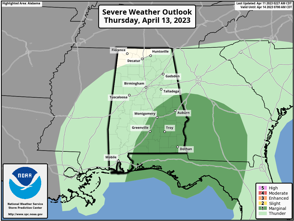
A few storms across Southeast Alabama could produce strong gusty winds and small hail Thursday afternoon. A brief tornado can’t be totally ruled out, but isn’t likely. A few lingering showers are possible Friday, mainly over North Alabama, as the surface low continues to move northward. A decent part of the day will be dry, however. Expect highs in the 70s both Thursday and Friday.
THE ALABAMA WEEKEND: Saturday looks generally dry and warm with a high in the low to mid 80s for most places. Expect a mix of sun and clouds, and any showers should be few and far between. Then we will mention a chance of showers Saturday night into early Sunday morning as a surface front moves through… some thunder is possible, but severe storms are not expected. Dry air returns during the day as the sky becomes partly to mostly sunny; the high Sunday will be in the 70s.
NEXT WEEK: For now the entire week looks dry with warm afternoon and pleasant nights. The high Monday will be in the upper 70s, followed by low to mid 80s for the rest of the week. See the video briefing for maps, graphics, and more details.
ON THIS DATE IN 1965: Severe thunderstorms in the Upper Midwest spawned 51 tornadoes killing over 250 people and causing more than 200 million dollars damage. Indiana, Ohio and Michigan were hardest hit in the “Palm Sunday Tornado Outbreak”. Although no F5’s were officially reported, at least 22 were rated as F3 or F4. This is the third deadliest day for tornadoes on record, behind the Super Outbreak of 4/3/1974, and the outbreak that included the Tri-State Tornado of 3/18/1925. Dr. Ted Fujita discovered suction vortices during the Palm Sunday tornado outbreak.
ON THIS DATE IN 2011: Severe thunderstorms produced wind damage in scattered pockets across Alabama, and a brief EF-1 tornado touched down in Vestavia Hills. It was the first in a series of severe weather events that month that could culminate with the generational tornado outbreak on April 27, 2011.
BEACH FORECAST: Click here to see the AlabamaWx Beach Forecast Center page.
Look for the next video briefing here by 6:00 a.m. tomorrow…
Category: Alabama's Weather, ALL POSTS, Weather Xtreme Videos
About the Author (Author Profile)
James Spann is one of the most recognized and trusted television meteorologists in the industry. He holds the AMS CCM designation and television seals from the AMS and NWA. He is a past winner of the Broadcast Meteorologist of the Year from both professional organizations.Subscribe
If you enjoyed this article, subscribe to receive more just like it.


