

Strong Storm Moving Across Northern Blount County; Golf Ball Sized Hall Near Cullman Earlier
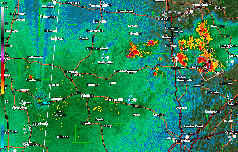
The severe thunderstorm warning that was in effect for Cullman County has expired. That storm is now affecting northern Blount County and the NWS Birmingham has issued a significant weather advisory. Affected locations include Summit, Brooksville, and Snead. Albertville and Douglas in Marshall County will also be affected.
Golf ball-sized hail was reported on US-278 east of Cullman at 1:51 a.m.
The storm is weaker than it was, losing all of its hail indications, but it will still have gusty winds and very heavy rain.
Storms are active along and north of the US-278 Corridor. These cells will move into Northeast Alabama.
Down south, new storms have fired across Lowndes County up into southeastern Chilton County. They will move into Coosa and Elmore counties.
The storms moving into Lauderdale County have weakened. There is one cell north of Amory MS that will affect Marion County. It is not severe.
Category: Alabama's Weather, ALL POSTS, Severe Weather
About the Author (Author Profile)
Bill Murray is the President of The Weather Factory. He is the site's official weather historian and a weekend forecaster. He also anchors the site's severe weather coverage. Bill Murray is the proud holder of National Weather Association Digital Seal #0001 @wxhistorianSubscribe
If you enjoyed this article, subscribe to receive more just like it.


