

Midday Nowcast: Rain is Back
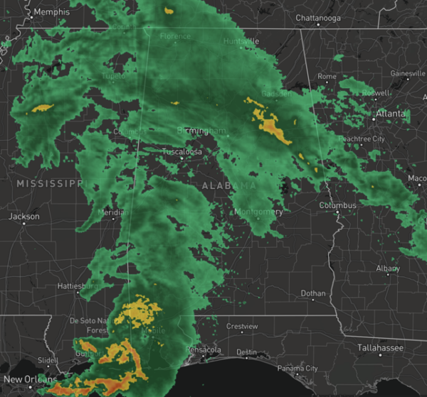
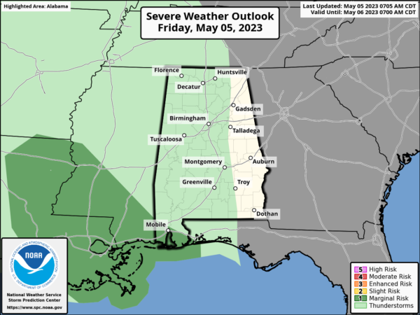
A warm front lifting north through Alabama has been the culprit for the areas of rain today across Alabama. This afternoon, scattered rain and storms will continue to highlight our local weather with a mainly cloudy sky. There is a wide range in temperatures this afternoon with upper 60s across the northern third of the state to the mid 80s for South Alabama. We will mention the SPC maintains a low end “marginal risk” (level 1/5) of severe thunderstorms across the extreme southwest corner of the state today, where a few strong storms are possible.
USA BRIEF: Severe thunderstorms capable of large hail and damaging winds are possible across parts of central Texas. Heavy rainfall may lead to areas of flash flooding is possible over the Mid-Mississippi and Tennessee River Valleys and interior Northwest. Dry, gusty winds will bring elevated to critical fire weather conditions in parts of the Southwest into the Southern Plains through Saturday.
WEEKEND WEATHER: Tomorrow and Sunday will be warm and humid with afternoon highs in the low 80s both days. Expect a mix of sun and clouds both days and we will mention the chance of scattered showers and storms, mainly during the afternoon and evening hours. No way of knowing when and where rain will occur, you just have to watch radar trends through the day.
NEXT WEEK: A very summer-like pattern will be in place over the state through the week. Daily scattered showers will remain in the forecast for much of the week, mainly during the afternoon and evening hours, with the higher chances early in the week. Highs will be in the mid 80s, and could likely approach 90 degrees in spots for the second half of the week.
BEACH FORECAST CENTER: Get the latest weather and rip current forecasts for the beaches from Fort Morgan to Panama City on our Beach Forecast Center page. There, you can select the forecast of the region that you are interested in visiting.
WORLD TEMPERATURE EXTREMES: Over the last 24 hours, the highest observation outside the U.S. was 117.1F at Matam, Senegal. The lowest observation was -97.1F Concordia, Antarctica.
CONTIGUOUS TEMPERATURE EXTREMES: Over the last 24 hours, the highest observation was 100F at Rio Grande Village, TX. The lowest observation was 19F at Ryegate, MT.
Category: Alabama's Weather, ALL POSTS
About the Author (Author Profile)
Macon, Georgia Television Chief Meteorologist, Birmingham native, and long time Contributor on AlabamaWX. Stormchaser. I did not choose Weather, it chose Me. College Football Fanatic. @Ryan_StinnetSubscribe
If you enjoyed this article, subscribe to receive more just like it.


