

The Sunday Afternoon Alabama Weather Story

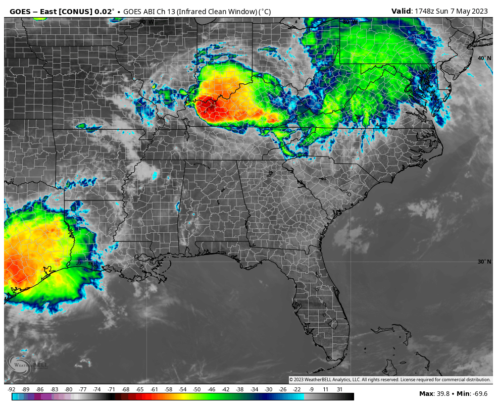
Skies are partly cloudy to mostly sunny across all of Alabama at the 1 p.m. hour. The nearest precipitation to Alabama with a complex of thunderstorms diving south through southern Kentucky, and some showers from a dying storm complex near the Mississippi River back over southeastern Arkansas and northeastern Louisiana.
There is a large area of rain and storms over southeastern Texas, but cloud tops have been warming over the past couple of hours, indicating the the storms are weakening.
Temperatures are in the 80s over the state now, with perhaps a holdout or two over East Alabama, where you might find a reading in the upper 70s.
The storms over Kentucky are expected to slowly drop southward across Tennessee through the evening hours and perhaps reach North Alabama after midnight. The HRRR indicates they may reach as far south as Cullman, Gadsden, and Anniston by 5-7 a.m., but perhaps won’t make it all the way to Birmingham/Jasper/Tuscaloosa except as showers. The SPC does have the Tennessee Valley outlooked in a marginal risk (1level 1/5) for tonight into early Monday morning.
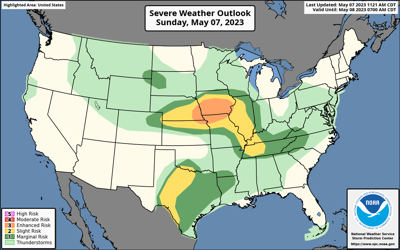
The showers will retire to the south of Birmingham tomorrow afternoon but are not expected to be severe. Additional showers and storms will form over Middle Tennessee during the afternoon and move down into Northeast Alabama tomorrow evening. The SPC has a marginal risk for severe storms for the Tennessee Valley again on Monday. Wind and hail will be the only threats for Alabama.
The tornado threat today is up in Iowa, where some big hail may fall again this afternoon and evening. They will be measuring the hail in comparison to golfballs, baseball, and softballs, with even some Ruby Red grapefruit thrown in. That is some scary stuff.
More scattered showers and storms will develop on Tuesday.
Lows tonight will be in the 60s areawide. Highs tomorrow will be in the 80s. Upper 80s will be common by Tuesday and Wednesday.
A typical summer time pattern sets in later in the week with scattered afternoon and evening storms Wednesday through Friday. The weekend looks even a little drier, but still above normal in the temperature department. This week’s normal highs in Birmingham are between 80-82, and the lows between 58-61.
Category: Alabama's Weather, ALL POSTS, Severe Weather
About the Author (Author Profile)
Bill Murray is the President of The Weather Factory. He is the site's official weather historian and a weekend forecaster. He also anchors the site's severe weather coverage. Bill Murray is the proud holder of National Weather Association Digital Seal #0001 @wxhistorianSubscribe
If you enjoyed this article, subscribe to receive more just like it.


