

Flood Warning Replaces Flash Flood Warning for Parts of Lawrence Co. Until 9:30 pm
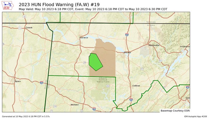
…FLOOD WARNING IN EFFECT UNTIL 630 PM CDT THIS EVENING…
…REPLACES FLASH FLOOD WARNING…
* WHAT…Flooding caused by excessive rainfall is expected.
* WHERE…A portion of northwest Alabama, including the following
county, Lawrence.
* WHEN…Until 930 PM CDT.
* IMPACTS…Flooding of rivers, creeks, streams, and other low-lying
and flood-prone locations is imminent or occurring. Expect many
areas of slow moving or standing water.
* ADDITIONAL DETAILS…
– At 616 PM CDT, Doppler radar indicated heavy rain due to
thunderstorms earlier this evening. Between 2 and 4 inches of
rain fell, with additional heavy rainfall moving into the
area within about an hour and a half. This will aggravate
flooding issues ongoing in the area of western Lawrence
County.
– Some locations that will experience flooding include…
Landersville, Mt Hope, Hatton, Ne Smith and Bankhead National
Forest.
– http://www.weather.gov/safety/flood
PRECAUTIONARY/PREPAREDNESS ACTIONS…
Turn around, don’t drown when encountering flooded roads. Most flood
deaths occur in vehicles.
Category: Alabama's Weather, ALL POSTS
About the Author (Author Profile)
Scott Martin is an operational meteorologist, professional graphic artist, musician, husband, and father. Not only is Scott a member of the National Weather Association, but he is also the Central Alabama Chapter of the NWA president. Scott is also the co-founder of Racecast Weather, which provides forecasts for many racing series across the USA. He also supplies forecasts for the BassMaster Elite Series events including the BassMaster Classic.Subscribe
If you enjoyed this article, subscribe to receive more just like it.


