

Radar Update: Strong Storms Approaching West Alabama
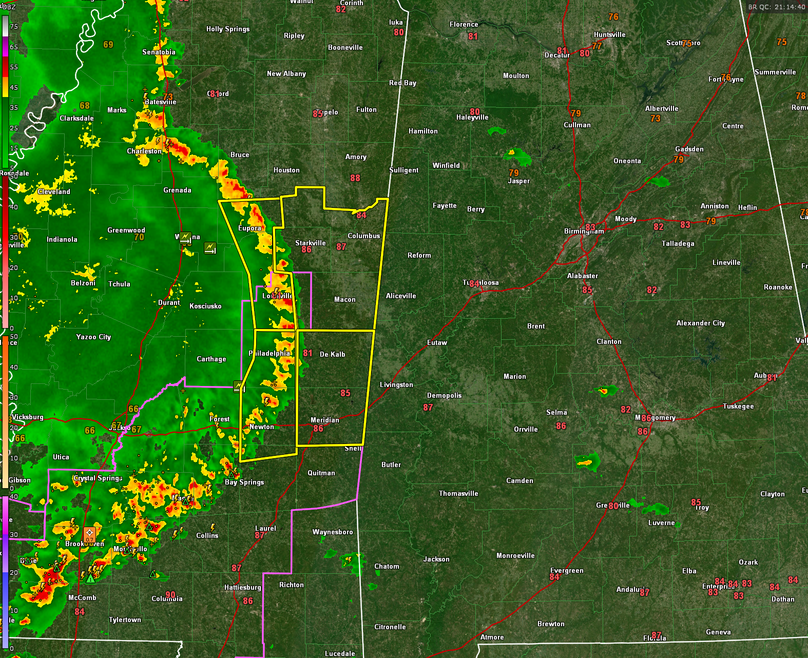
An arc of strong thunderstorms is less than an hour out now from West Alabama’s Lamar, Pickens, Greene, and Sumter Counties.
Severe thunderstorm warnings are in effect for several East Mississippi Counties.
The storms have a history of producing wind damage in Mississippi, including downed trees near Winona and Kilmichael.
The environment downstream of the storms is unstable as one would figure across Alabama, but pressures are higher the further east you go, which should help the storms to eventually weaken. Infrared satellite imagery does indicate that the storms may be weakening in the middle of the arc, which is the closest part to West Alabama.
There is a tornado watch for South Central Mississippi, but I think the greater threat is damaging winds, and that threat will continue into early evening across West Central Alabama.
Be alert to these storms as they approach and be in a substantial structure away from windows. You do not want to be out driving when they arrive due to the threat of falling trees or limbs.
Category: Alabama's Weather, ALL POSTS, Severe Weather
About the Author (Author Profile)
Bill Murray is the President of The Weather Factory. He is the site's official weather historian and a weekend forecaster. He also anchors the site's severe weather coverage. Bill Murray is the proud holder of National Weather Association Digital Seal #0001 @wxhistorianSubscribe
If you enjoyed this article, subscribe to receive more just like it.


