

While a Watch is Not Likely, A Few Strong Storms are Possible Over the Tennessee Valley Region of Alabama
FROM THE SPC’S MESOSCALE DISCUSSION #798
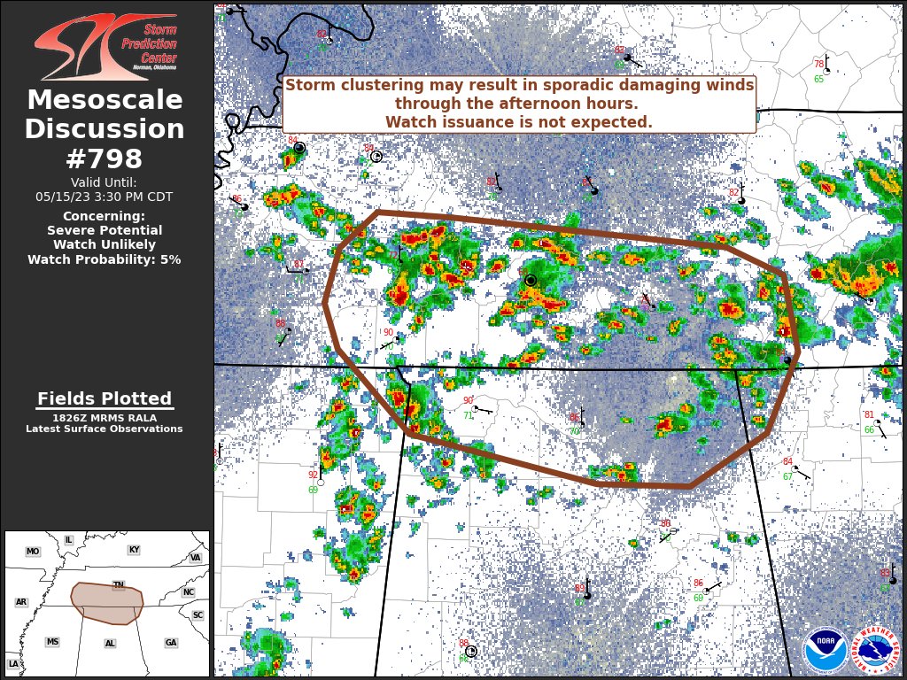
SUMMARY… Thunderstorm clustering is probable over the next few hours across southern Tennessee into adjacent portions of northern Alabama and northwest Georgia.
DISCUSSION… Over the past 1–2 hours, scattered thunderstorms have developed across Middle TN along a diffuse warm frontal zone. Much of this activity has been rather short-lived, with periodic intense updraft pulses followed by rapid weakening; a consequence of the weakly sheared environment. However, temperatures warming into the low 80s has allowed for surface-based parcels to reach their convective temperatures, which will foster additional convective development along outflows and/or within the frontal zone. While sporadic/isolated damaging downburst winds are possible with more intense, but transient, cells, a somewhat more organized wind threat may emerge if cold pool amalgamation can lead to more organized clustering. Based on latest radar trends, this appears most probable along the TN/AL border through the late afternoon hours, downstream from a region with a higher concentration of disorganized convection (where cold pool consolidation is most probable). Given the overall poor organization of the convection and weak kinematic fields, watch issuance is not expected.
Category: Alabama's Weather, ALL POSTS, Severe Weather
About the Author (Author Profile)
Scott Martin is an operational meteorologist, professional graphic artist, musician, husband, and father. Not only is Scott a member of the National Weather Association, but he is also the Central Alabama Chapter of the NWA president. Scott is also the co-founder of Racecast Weather, which provides forecasts for many racing series across the USA. He also supplies forecasts for the BassMaster Elite Series events including the BassMaster Classic.Subscribe
If you enjoyed this article, subscribe to receive more just like it.


