

Midday Nowcast: More Storms Later Today
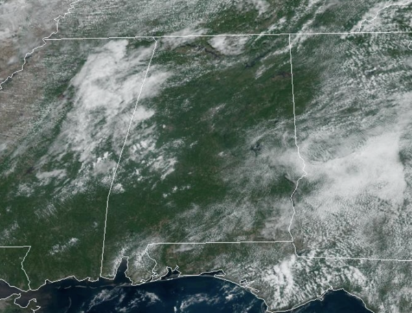
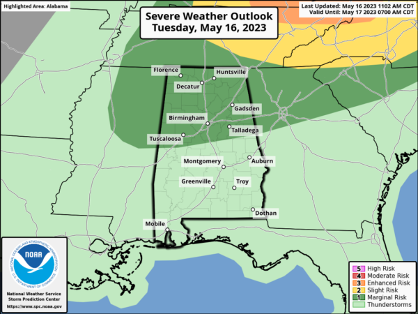
Rain chances are higher today as a surface front is dropping into the Tennessee Valley. The SPC has roughly the northern half of Alabama in a “marginal risk” (level 1/5) of severe storms the rest of today and into tonight.
Stronger storms later today will be capable of producing hail and strong winds; tornado threat is near zero. Of course, storms this time of year are prolific rain producers and it doesn’t take long to get areas of isolated flash flooding. While we wait on the storms, it is hot and humid with highs in the upper 80s to mid 90s across Alabama. Rain chances are in the 50-70% range, meaning a lot of spots will see rain, however, many spots will remain dry.
REST OF WEEK: Our heat levels come down as highs will drop into the lower 80s the next few days. The highest coverage of showers and storms will come during the afternoon and evening hours as the boundary meanders about Central Alabama. It won’t rain all day, and it won’t rain everywhere, but the chance of any one spot getting wet each day will remain in the 50-70% range.
WEEKEND WEATHER: Another front will move into and through the state Saturday allowing for the continued higher chances rain and storms. Sunday will be a sunny and dry day with lower humidity and afternoon highs in the upper 70s to lower 80s. Morning lows, are likely to be in the 50s in many locations across North/Central Alabama.
INTO NEXT WEEK: Model guidance is now suggesting moist air will begin return early in the week with increasing chances of scattered showers and storms. The rest of the week looks fairly quiet with a few isolated showers around daily along with highs in the 80s.
BEACH FORECAST CENTER: Get the latest weather and rip current forecasts for the beaches from Fort Morgan to Panama City on our Beach Forecast Center page. There, you can select the forecast of the region that you are interested in visiting.
WORLD TEMPERATURE EXTREMES: Over the last 24 hours, the highest observation outside the U.S. was 114.8F at Bilma, Niger. The lowest observation was -98.1F Concordia, Antarctica.
CONTIGUOUS TEMPERATURE EXTREMES: Over the last 24 hours, the highest observation was 111F at Death Valley, CA. The lowest observation was 27F at Peter Sinks, UT.
Category: Alabama's Weather, ALL POSTS
About the Author (Author Profile)
Macon, Georgia Television Chief Meteorologist, Birmingham native, and long time Contributor on AlabamaWX. Stormchaser. I did not choose Weather, it chose Me. College Football Fanatic. @Ryan_StinnetSubscribe
If you enjoyed this article, subscribe to receive more just like it.


