

Showers/Storms This Evening/ Cool May Day Tomorrow
RADAR CHECK: Showers and thunderstorms continue to develop across Alabama this afternoon in scattered spots; heavier storms are across the southeast counties of the state, where SPC maintains a “marginal risk” of severe storms through early tonight.
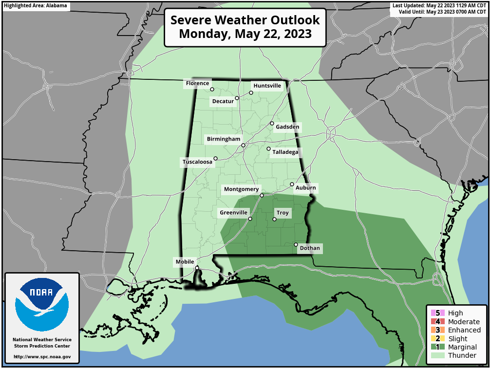
The main threat from heavier storms will come from strong winds, but some hail is possible as well over the next few hours for areas southeast of Montgomery. Showers elsewhere will fade late tonight.
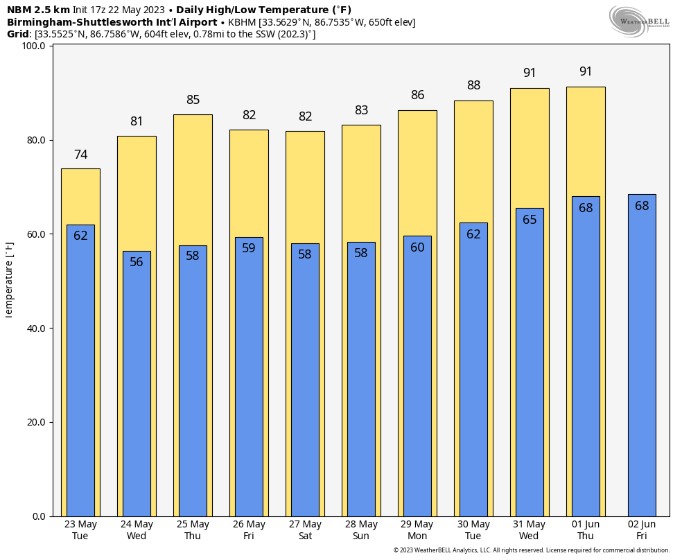
Showers remain possible tomorrow as the upper low continues to move slowly through the region; they will be most numerous over the southern 2/3 of the state. The day will be very cool for late May with highs in the 70-75 degree range for most places… 10-15 degrees below average.
WEDNESDAY THROUGH FRIDAY: Drier air moves into the state Wednesday and Thursday, and we expect generally rain-free weather both days with a partly to mostly sunny sky. Afternoon highs will be in the 80s. On Friday we will introduce the chance of a few widely scattered showers, but for now we don’t expect any widespread or heavy rain. Friday’s high will be in the low 80s with a mix of sun and clouds.
THE ALABAMA WEEKEND: We believe most of the weekend will be dry, but we will maintain the chance of a few isolated showers both days, mainly during the afternoon and evening hours. Expect a partly sunny sky with highs in the 80s.
NEXT WEEK: The week looks fairly quiet with no major weather systems impacting the Deep South. There will be a few days with the usual risk of widely scattered afternoon/evening showers or storms, however. Heat levels begin to rise, and by the end of the week afternoon highs will be close to 90. See the video briefing for maps, graphics, and more details.
TROPICS: Disorganized showers and a few thunderstorms associated with a broad area of low pressure located a couple of hundred miles northeast of the central Bahamas have decreased since yesterday. Environmental conditions have become more hostile and development of this system is not expected while it moves north-northeastward at 5 to 10 mph over the southwestern Atlantic during the next day or so. The rest of the Atlantic basin is quiet… the hurricane season officially begins June 1.
ON THIS DATE IN 1986: A devastating hailstorm hit the Sichuan Province of China. Reports indicate that up to 100 people were killed, 35,000 homes destroyed and entire crops devastated.
ON THIS DATE IN 2011: On this day, one of the most devastating tornadoes in the nation’s history directly killed 158 people and injured over 1,000 in Joplin, Missouri. The Joplin EF5 tornado was the first single tornado to result in over 100 fatalities since the June 8, 1953, Flint, Michigan tornado.
Look for the next video briefing here by 6:00 a.m. tomorrow…
Category: Alabama's Weather, ALL POSTS, Weather Xtreme Videos
About the Author (Author Profile)
James Spann is one of the most recognized and trusted television meteorologists in the industry. He holds the AMS CCM designation and television seals from the AMS and NWA. He is a past winner of the Broadcast Meteorologist of the Year from both professional organizations.Subscribe
If you enjoyed this article, subscribe to receive more just like it.


