


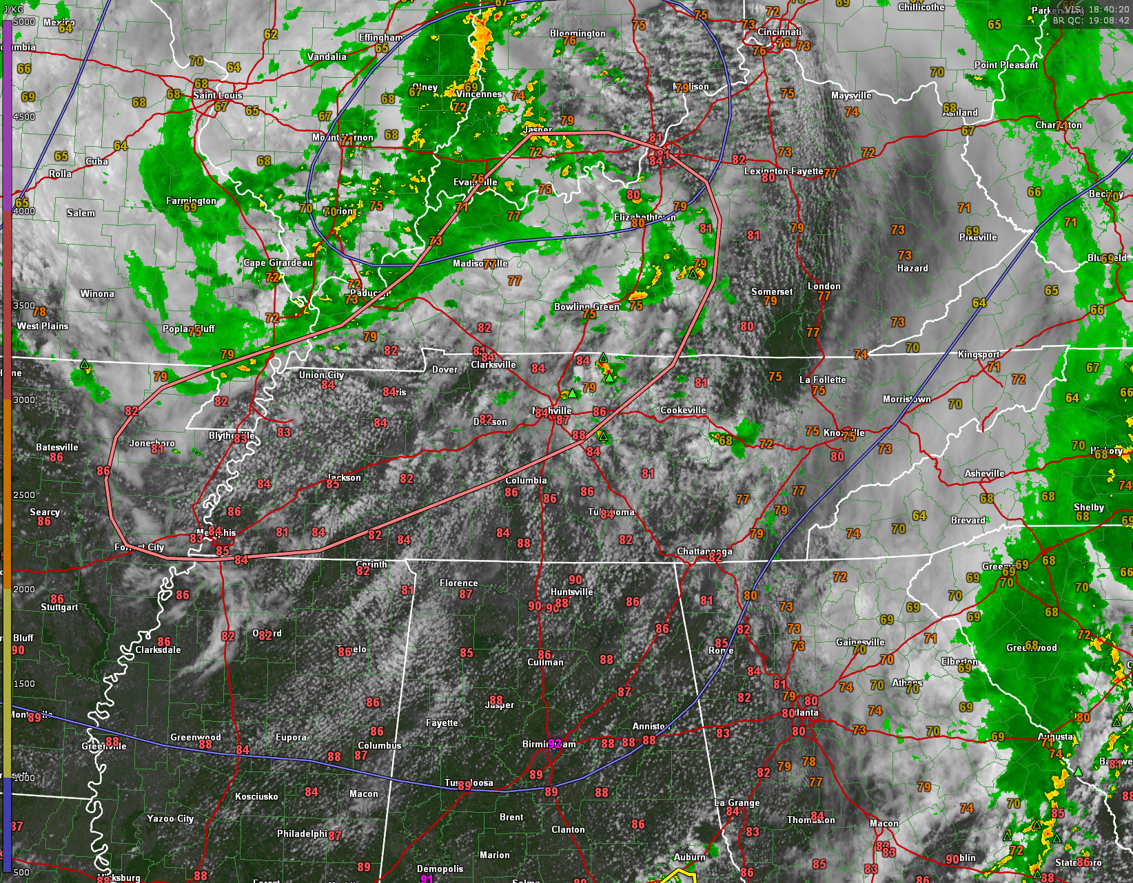
The SPC has issued a Mesoscale Discussion indicating that a severe weather watch, like a severe thunderstorm watch is likely from northeastern Arkansas across western Tennessee and into western Kentucky.
Mesoscale Discussion 0974
NWS Storm Prediction Center Norman OK
0156 PM CDT Sun Jun 11 2023
Areas affected…from much of central and western Kentucky into
Tennessee and northeast Arkansas
Concerning…Severe potential…Watch likely
Valid 111856Z – 112130Z
Probability of Watch Issuance…80 percent
SUMMARY…Strong to severe storms are expected to develop by 20Z
from western Kentucky and Tennessee into northeast Arkansas.
Scattered wind damage and sporadic hail will be possible.
DISCUSSION…An initial wave is currently moving across southern IL
into IN, with an associated area of showers and thunderstorms. These
storms extend from a surface low near the IL/IN border, curving
southwestward toward the MO/AR border. Shear remains weak over
northern areas, with the stronger midlevel flow south of the OH
River and into AR.
Heating continues to gradually destabilize the air mass ahead of the
initial wave, with MLCAPE approaching 2000 J/kg over KY and TN.
Stronger instability exists over AR, where temperatures are warmer.
Visible imagery shows Cu fields from KY into TN, while surface
observations indicate the strongest convergence from northeast AR
into western KY. This general zone may be the most likely zone for
diurnal development later today.
Winds aloft are generally averaging 30-40 kt, with speeds
approaching 50 kt at 500 mb noted on HPX/OHX/LVX VWPs. This will
support deep-layer shear favorable for a few long-lived storms,
possible a mixture of cellular and linear storm modes, moving
southeastward later today and into the evening. Scattered damaging
winds appear to be the main concern, with sporadic large hail
possible as well as midlevel temperatures remain cool and the air
mass destabilizes further.
..Jewell/Thompson.. 06/11/2023


