


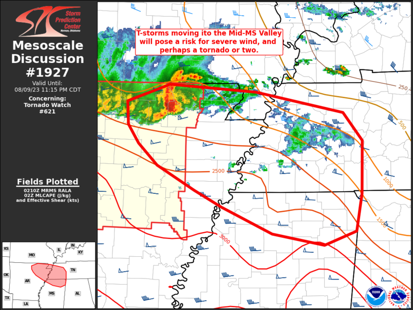
SUMMARY… Thunderstorms moving into northeast Arkansas will eventually migrate into the mid-Mississippi Valley heading into the late evening hours. These storms will pose a risk for severe/damaging winds and perhaps a tornado or two. A downstream watch will likely be needed.
DISCUSSION… A supercell embedded within the leading edge of a line of storms continues to propagate to the east/southeast into northeast AR. This supercell has shown signs of gradual transition a more organized linear mode (some signs of an organized gust front are noted in KNQA imagery), but this evolution has been gradual. A strengthening low-level jet will bolster warm air advection over a residual baroclinic zone that is draped from northeast AR to northern MS/AL. The expectation over the next few hours is for this cell to continue to grow upscale amid increasing lift along the frontal zone, propagating to the southeast into the mid-MS River Valley. VWP observations at KNQA sampled 50-60 knot mid-level flow as well as 0-1 km SRH near 350 m2/s2 within the warm advection regime. This kinematic environment will continue to support storm organization for the next several hours with an attendant risk of severe winds and perhaps a tornado or two – though the tornado threat will likely be conditional on the development of a more organized MCS, which remains uncertain. Regardless, a downstream watch will likely be needed to address this concern.


