


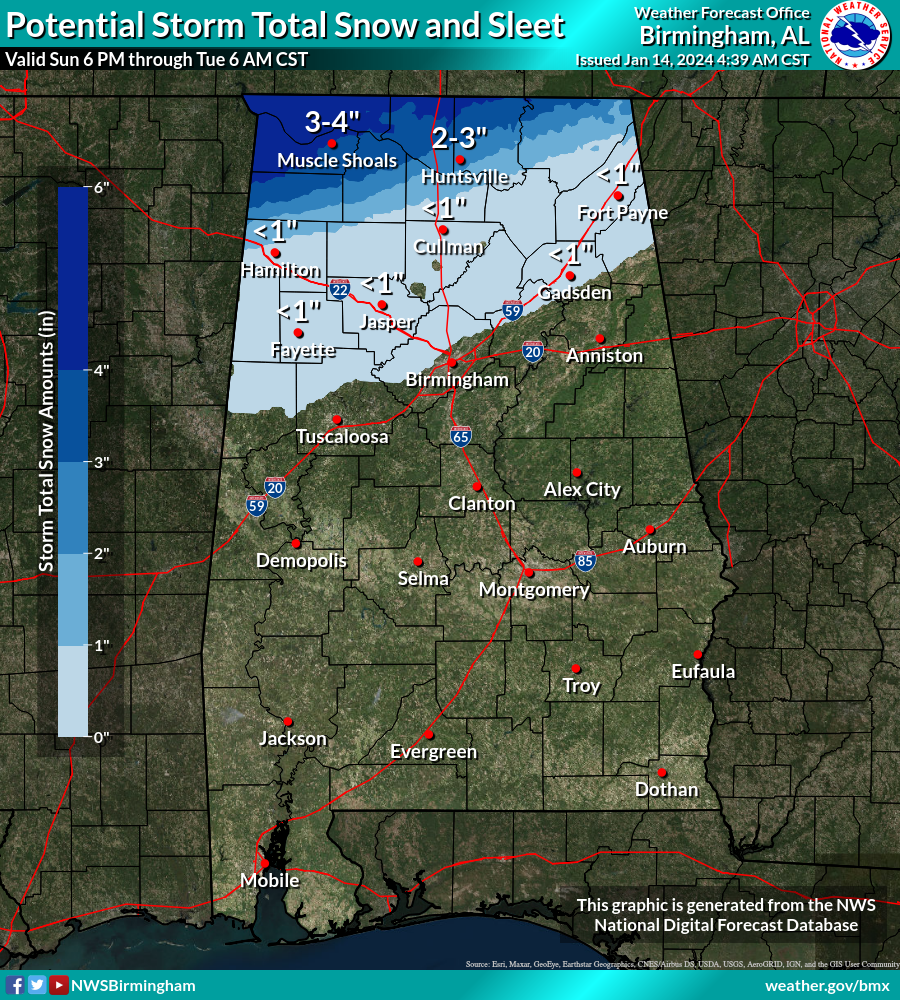
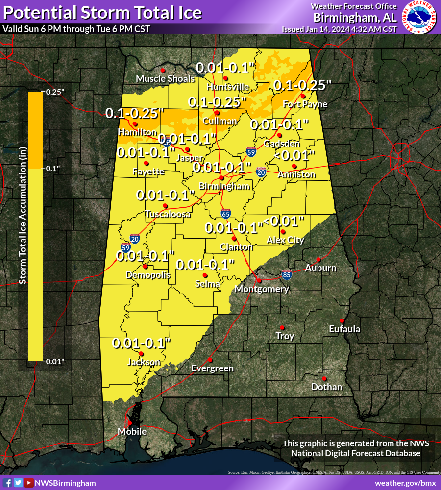
Here are the latest storm total forecast snow and ice graphics from the National Weather Service National Digital Forecast Database:
Snow:
Ice:
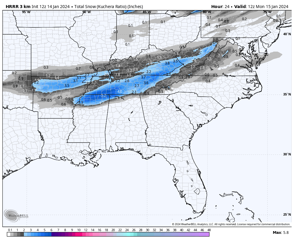
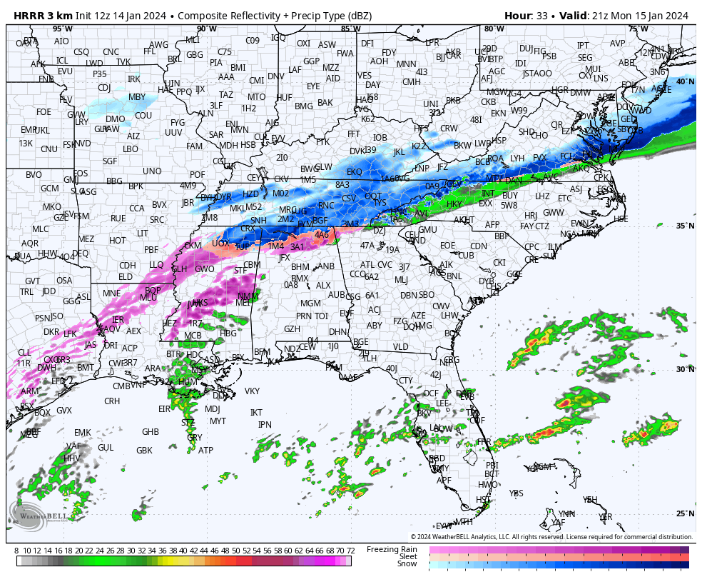
There is a great deal of uncertainty in timing of the impacts for North and Central Alabama, but here are some first thoughts from our HRRR high resolution model.
A mix of snow, sleet and freezing rain could reach northwestern counties of Alabama as early between 4 and 7 p.m. tonight mostly in the Winter Storm Warning area.
It will continue to be snow over the northernmost counties of the Tennessee valley tomorrow morning.
Snow accumulations could look like this by morning:
With a little ice just south of there.
Freezing rain and snow along with some sleet will intensify through the day Monday:
Freezing rain will begin over North Central Alabama between 5-7 p.m. Monday:
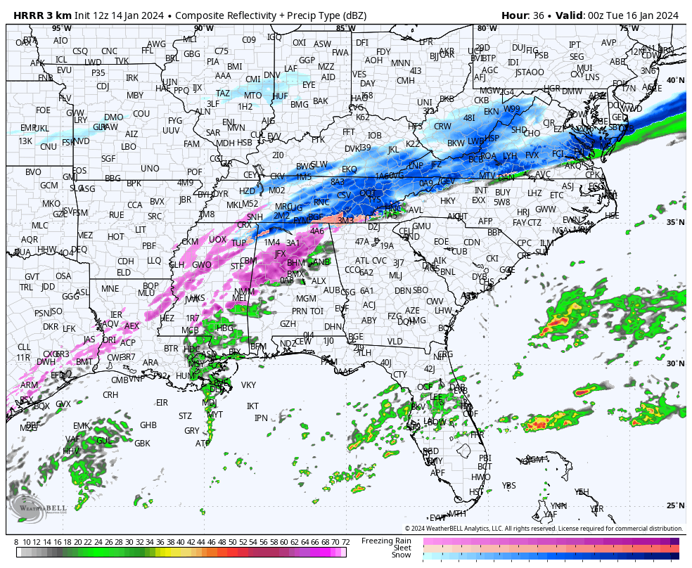
The band of freezing rain will spread southward through midnight Monday night:
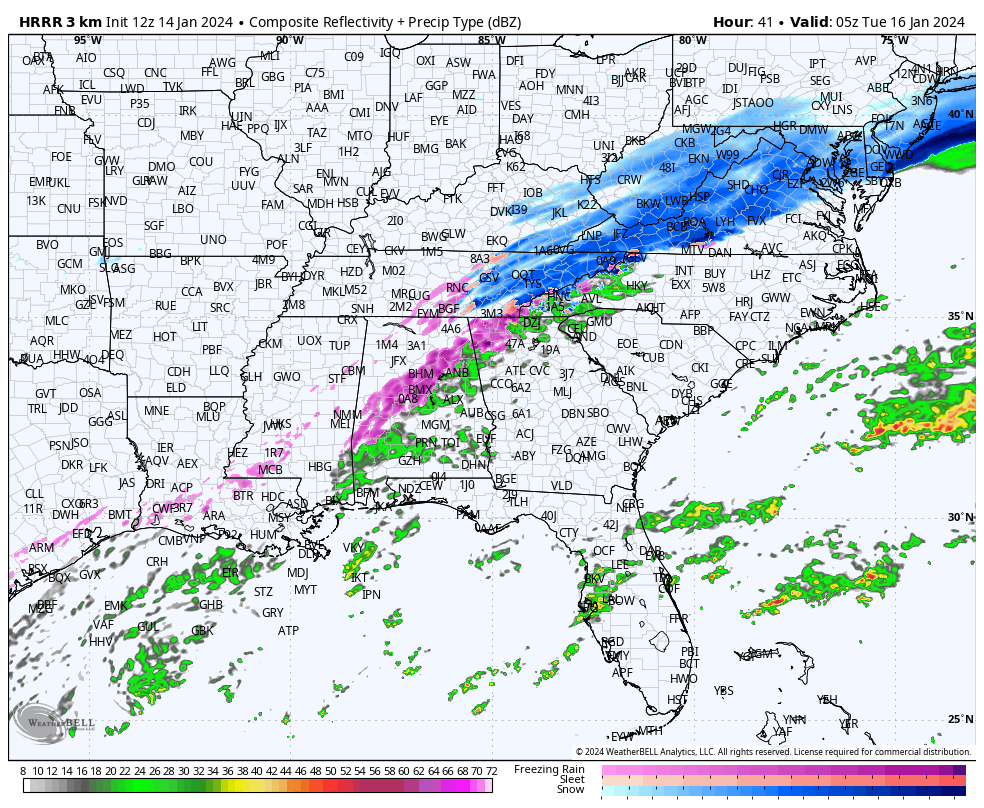
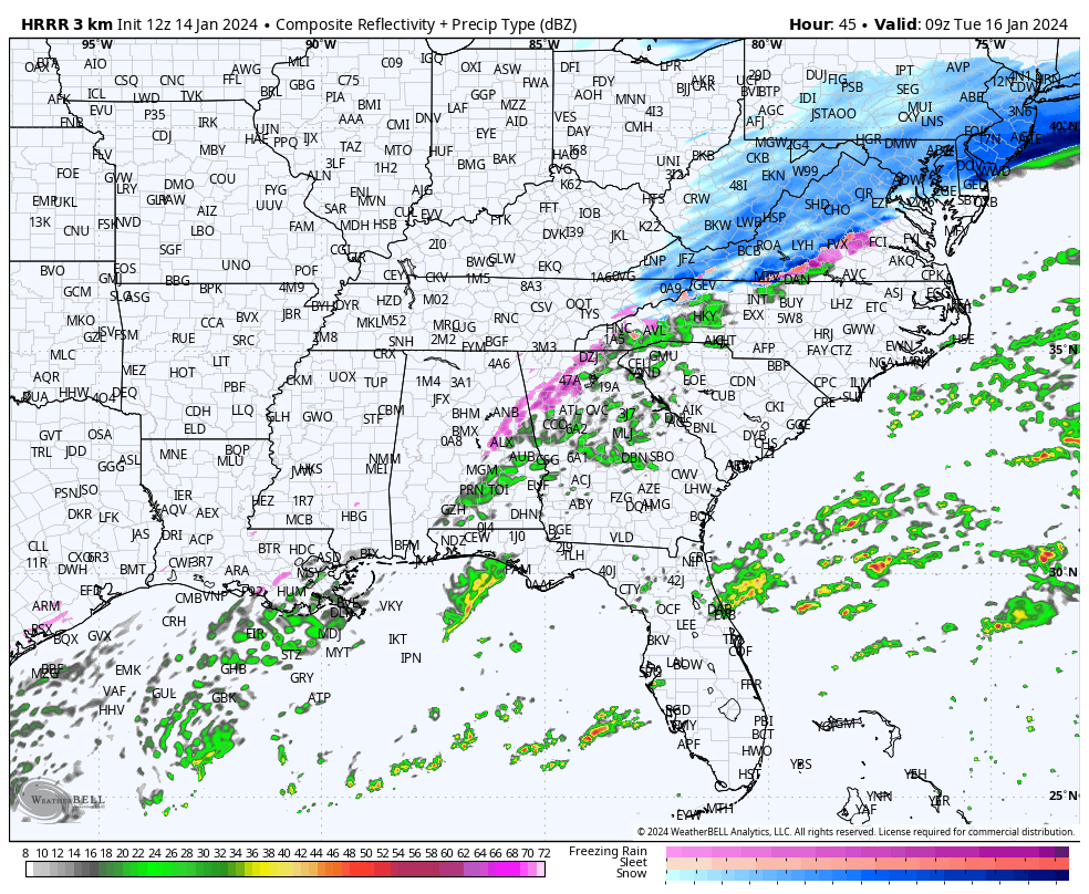
The freezing rain will begin to move out by 3 a.m. Tuesday morning:
Tuesday highs will stay below freezing with a cold northwest wind gusting to 20 mph, which will push wind chill values below zero over the northern third of the state state with sincgle digits across Central Alabama and teens into South Alabama.


