


WINDY DAY, STORMY NIGHT: Gradient winds are ramping up today ahead of our next storm system with southerly winds of 15-25 mph and higher gusts.
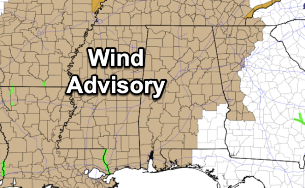
A wind advisory is in effect for nearly all of Alabama as these winds will increase even more tonight. Winds tonight will average 20-30 mph, with potential for gusts to 40/45 mph in spots. Be sure and secure any loose objects on your property, and know there could be a few scattered power outages tonight. Winds will diminish after the thunderstorm line passes after midnight.
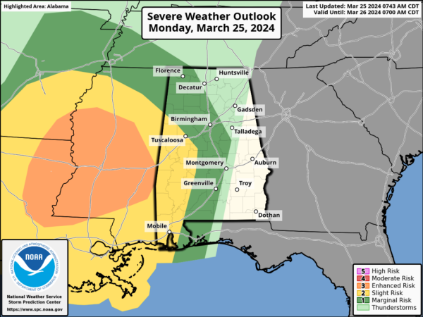
For the rest of the day, the weather stays dry, but our sky will remain generally cloudy with afternoon highs in the upper 60s and lower 70s. However, overnight, a band of showers and thunderstorms will push into Alabama late tonight. These storms will be strong and there could be a few severe storms, but the line of storms will be weakening as the push into and through the state. A large portion of Alabama is included in a risk of severe weather overnight, but there will be very little surface based instability for the storms as the move into Alabama. The main concern across West and Southwest Alabama will come from damaging wind gusts. The core severe weather threat late today and tonight will remain west of Alabama over parts of Arkansas, Louisiana, and Mississippi, where an “enhanced risk” (level 3/5) of severe weather has been outlined.
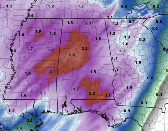
RAIN: Rain amounts will average 1.5-2.5 inches for most of Alabama over the next 36 hours; parts of West Alabama could see over 3 inches. Some flooding issues are possible. Most of the rain will come from 11PM through 11AM tomorrow.
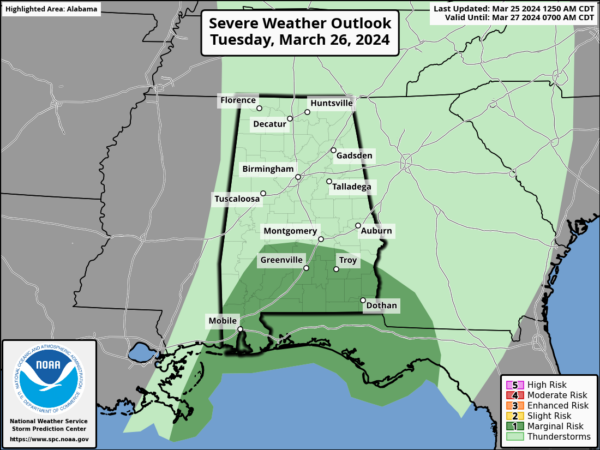
REST OF THE WEEK: Some clearing is possible tomorrow afternoon as dry air works into the Deep South; the high tomorrow will be in the low 70s in most places. Tomorrow morning, some rain and storms will remain possible of southern portions of Alabama and a “marginal risk” (level 1/5) as gusty winds will remain a threat.
Wednesday through Friday will be dry with cool mornings and pleasant afternoons. Highs will be in the mid to upper 60s with some low 70s. Colder spots across North Alabama could see lows in the mid to upper 30s early Friday morning.
EASTER WEEKEND: The weather looks dry and warmer with partly to mostly sunny days and fair nights. The high Saturday will be well into the 70s, with upper 70s and some lower 80s Sunday for much of Alabama. For those sunrise services Sunday, it will be clear with temperatures in the upper 40s and lower 50s. This will be an “EGG”ceptional weekend of weather for Alabama and the Deep South.
BEACH FORECAST CENTER: Get the latest weather and rip current forecasts for the beaches from Fort Morgan to Panama City on our Beach Forecast Center page. There, you can select the forecast of the region that you are interested in visiting.
WORLD TEMPERATURE EXTREMES: Over the last 24 hours, the highest observation outside the U.S. was 108.1F at Birni-N’Konni, Niger. The lowest observation was -88.8F at Amundsen-Scott South Pole Station, Antarctica.
CONTIGUOUS TEMPERATURE EXTREMES: Over the last 24 hours, the highest observation was 94F at Rio Grande Village, TX. The lowest observation was -7F at Kokadjo, ME.


