


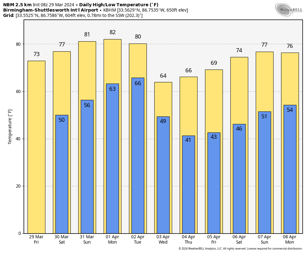
CHILLY START: Colder pockets are in the 30s across North Alabama early this morning with some patchy frost. We expect a nice warm-up today, however, with a high in the 70s this afternoon along with sunshine in full supply. Dry weather continues over the Easter weekend with highs in the 80-85 degree range by Sunday. The sky will stay mostly sunny both days.
NEXT WEEK: The weather stays warm and dry Monday, but showers and thunderstorms return to the state Tuesday and Tuesday night. SPC has defined a severe weather risk over the northern third of the state…
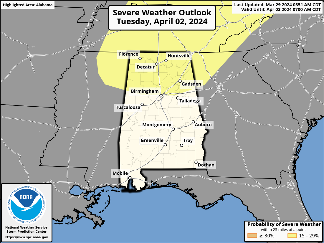
The high Tuesday will be close to 80, and the air will be unstable, which is favorable for severe thunderstorms. But the kinematic fields remain in question; the better forcing will most likely be north of the state with somewhat unidirectional wind profiles here. One we get within 60 hours of the event we will be much more specific about any severe weather threat. Rain amounts will be 1/2 to 1 inch over the northern half of the state, and under 1/2 inch for South Alabama.
The rest of the week will be dry but cooler. Highs drop into the 60s Wednesday and Thursday, and some scattered light frost will be possible over North Alabama early Thursday and Friday morning. See the video briefing for maps, graphics, and more details.
SOLAR ECLIPSE: Alabama will experience a partial solar eclipse on Monday April 8. The path of totality is to the north and west. Most of Alabama will have 80-90 percent of the sun is blocked; over 90 percent will be blocked at Muscle Shoals. The eclipse will begin around 12:40p CT… it peaks at 2:00p CT, and ends at around 3:15p CT. Of course, you will need the proper glasses to watch the eclipse safely.
Early ensemble output from global models suggests cloud cover could be an issue here, but that forecast could easily change.
ON THIS DATE IN 1942: A slow-moving low-pressure system brought 11.5 inches of snow to the nation’s capital on March 29, 1942. It still stands as the highest March snowfall on record in Washington, D.C. on a single calendar day. Also, Baltimore, Maryland recorded an imposing total of 21.9 inches of snow on the same day. On the flip side, eight days later, the temperature in D.C. soared to 92 degrees on April 6, 1942, and it remains the highest temperature on record for April 6.
ON THIS DATE IN 1991: An F1 tornado struck Munford, in Talladega County, killing five people, four of them in one family. The tornado was only on the ground for one mile and had a path width of just 300 feet. But it found eight mobile homes with deadly accuracy.
Look for the next video briefing here by 3:00 this afternoon… enjoy the day!


