


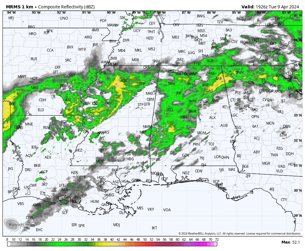
RADAR CHECK: Rain is fairly widespread over Alabama this afternoon with temperatures ranging from the 50s over the northern third of the state to the 70s across the southern counties. Periods of rain remain possible tonight along with some thunder.
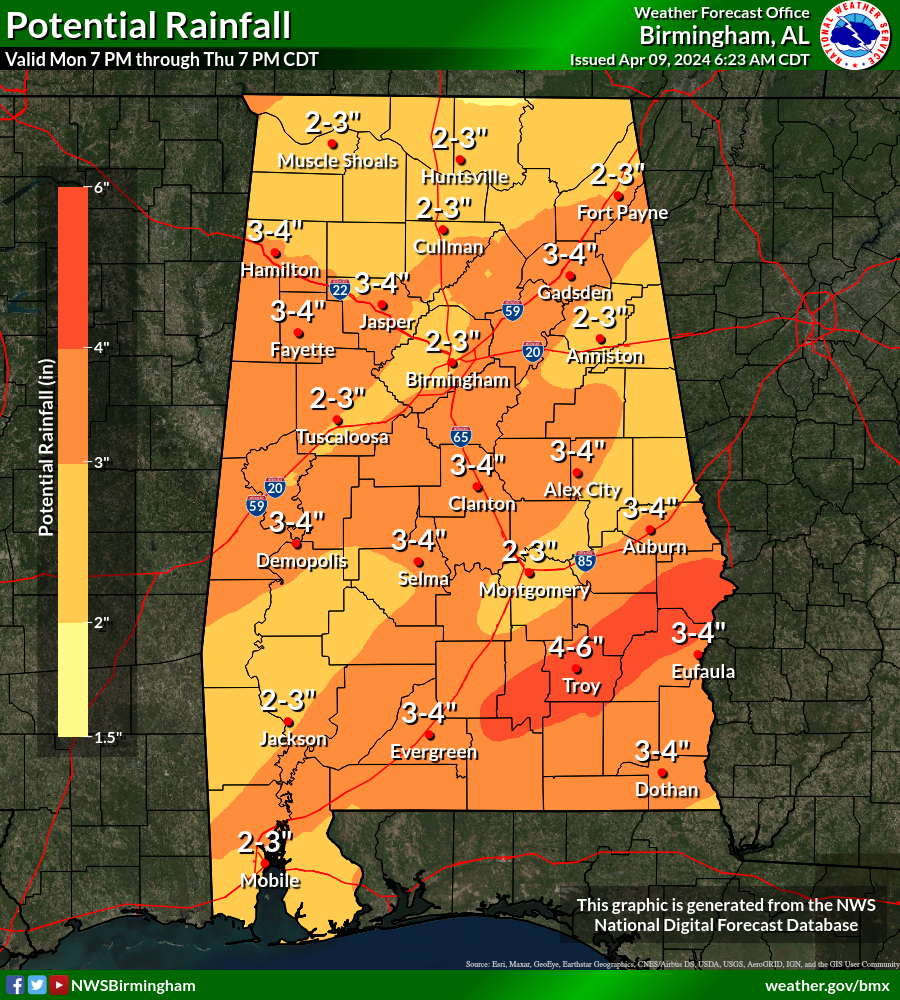
TOMORROW: Rain remains likely tomorrow and tomorrow night across the Deep South. The rain will be heavy at times, most of Alabama is under a flash flood watch. Amounts between 2 and 3 inches are likely over the next 72 hours.
A few strong, possibly severe thunderstorms are possible as well. SPC remains very aggressive in their outlook, defining a “moderate risk” (level 4/5) for Southwest Alabama. The rest of the state is in either an “enhanced” or “slight risk” (level 2-3/5).
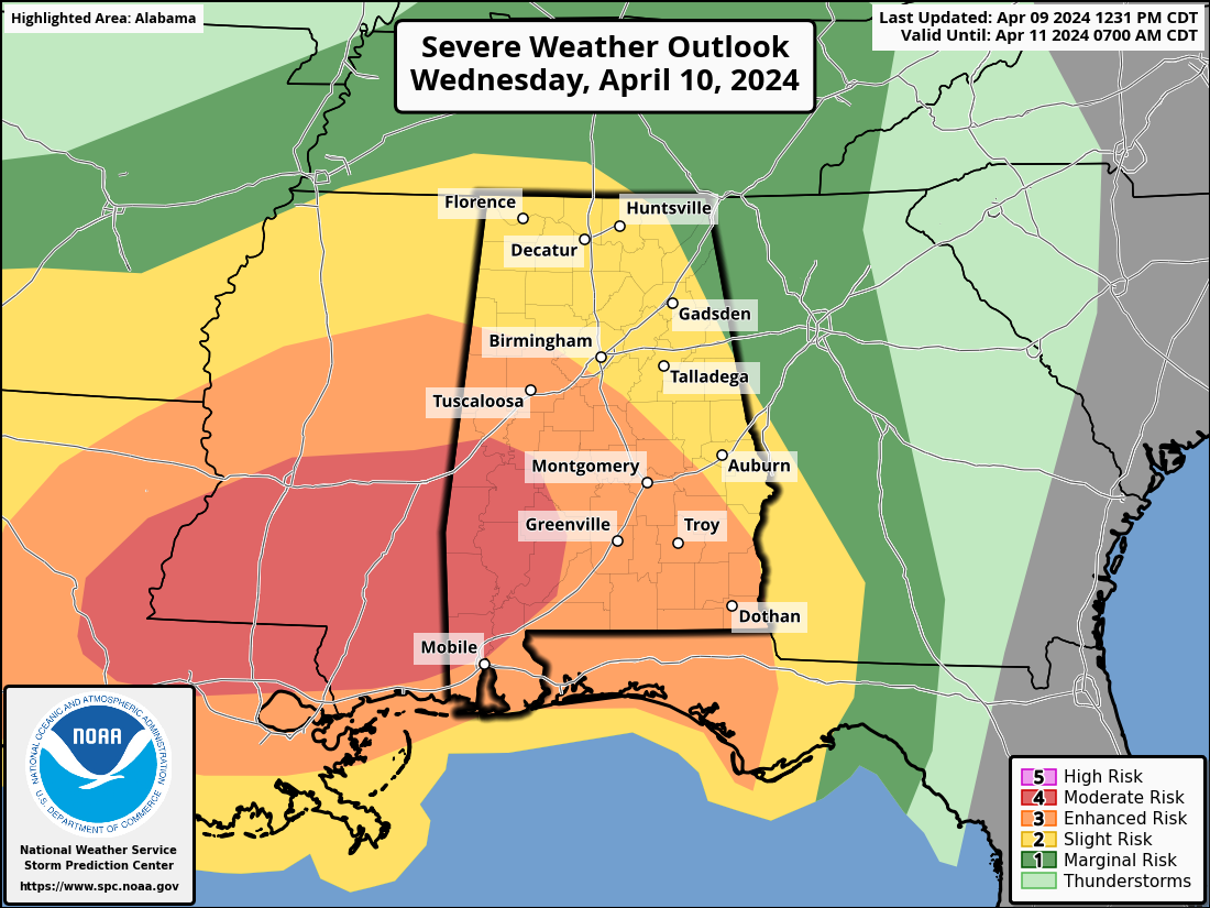
This is a very dynamic weather system, but with poor thermodynamic fields. Basically very little surface based instability. A large, rain cooled airmass should limit the overall severe weather threat for Alabama. Having said that, we have to watch any weather system like this closely in April. Highest chance of severe storms is along the Gulf Coast, where some instability is available. Storms across far South Alabama could produce strong winds, and an isolated tornado or two is possible. But clearly the main concern for most of the state is heavy rain and flooding potential.
Gradient winds (not related to thunderstorms) will ramp up tomorrow, gusting to 30/35 mph at times.
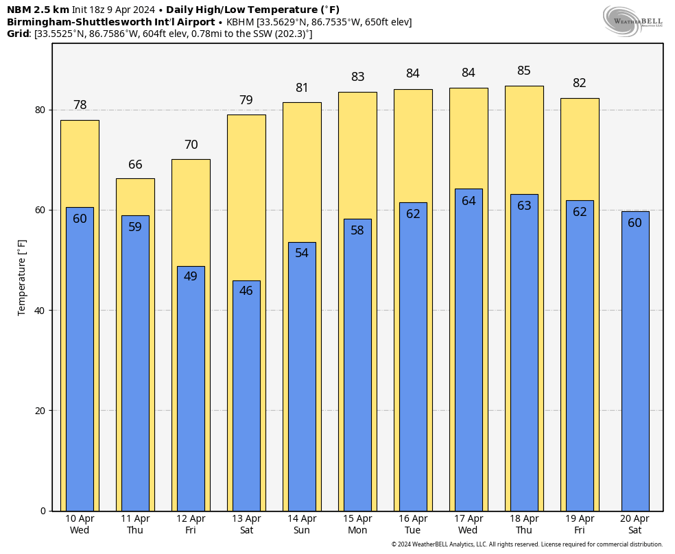
THURSDAY: Thursday will be a mostly cloudy, breezy, cool day with a chance of lingering showers. The high will be in the 60s over the northern half of the state with a gusty northwest wind. South Alabama could see some sun.
FRIDAY AND THE WEEKEND: The weather looks great with mostly sunny days and fair cool nights. Temperatures drop into the 40s early Friday and Saturday morning… the high will be close to 70 Friday, followed by upper 70s and low 80s over the weekend. Perfect spring weather.
NEXT WEEK: Looks like the warmest week so far this year with daily highs between 80 and 85 degrees. There will enough moisture around for a few isolated afternoon/evening showers on some days, but much of the week will be dry. See the video briefing for maps, graphics, and more details.
ON THIS DATE IN 1947: An estimated F5 tornado struck Woodward, Oklahoma during the late evening killing 95 persons and causing six million dollars damage. The tornado, one to two miles in width, and traveling at a speed of 50 mph, killed a total of 167 persons along its 221-mile path from Texas into Kansas.
Look for the next video briefing here by 6:00 a.m. tomorrow…


