


Hurricane Helene is expected to bring a range of significant impacts to Alabama, including strong winds, heavy rainfall, and the potential for flooding. While the tornado risk remains low, residents in the eastern and southeastern parts of the state should prepare for severe weather conditions, especially along and east of the I-65 corridor. This summary provides an overview of the anticipated effects by region and impact type. Power outages could become a problem, especially in areas that see gusts to 50 mph.
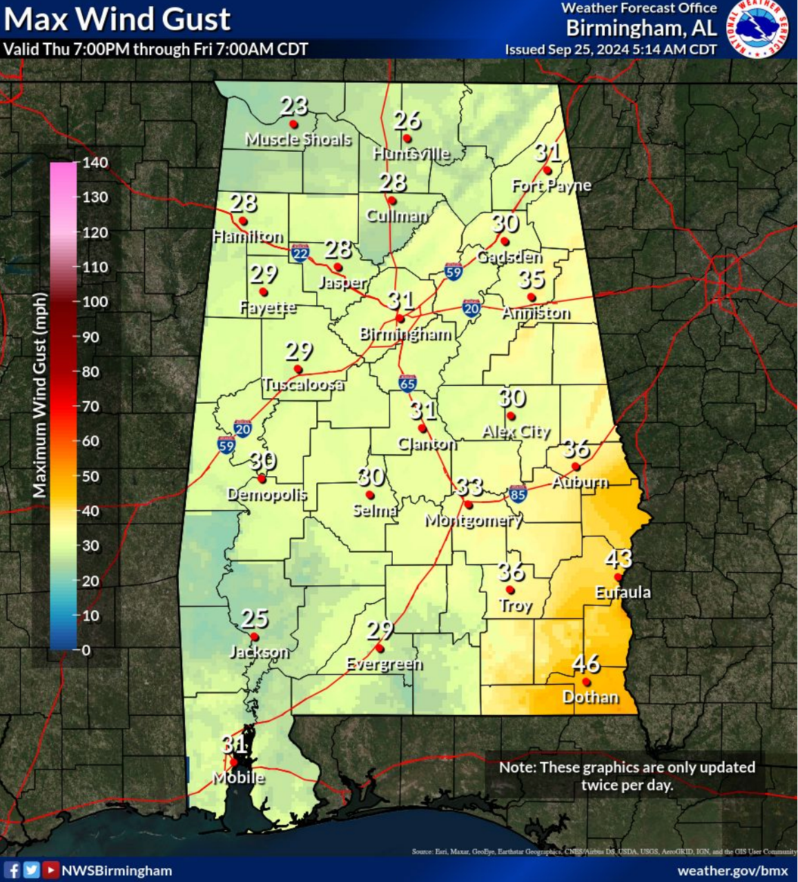
WIND:
Hurricane Helene is expected to bring significant wind impacts to Alabama to southeastern parts of the state. Wind gusts of 40-50 mph are forecast for southeastern Alabama, especially along and south of the I-85 corridor, including Lee, Macon, Russell, Bullock, Pike, Barbour, Coffee, Dale, Henry, Geneva, and Houston counties. Power outages are likely, and residents should prepare for downed trees and potential road closures. There coul dbe minor damage to structures as as well.
For the rest of Central Alabama wind gusts in the 28-35 mph range are more likely, with sporadic power outages possible as far west as the I-65 corridor.
Residents should secure outdoor items such as patio furniture, grills, and decorations to prevent them from becoming projectiles in high winds. It’s important to have an emergency kit ready with essentials like water, non-perishable food, batteries, and a flashlight. Those in areas prone to power outages should charge electronic devices and consider having backup power sources like generators. Ensure your home’s windows and doors are properly secured, and avoid parking vehicles under trees or power lines. Stay informed through reliable weather updates and be prepared to take shelter if conditions worsen.
Timing: Thursday evening through Friday. If the storm accelerates its forward motion, then the wind could arrive as early as Thursday afternoon.

FLOODING:
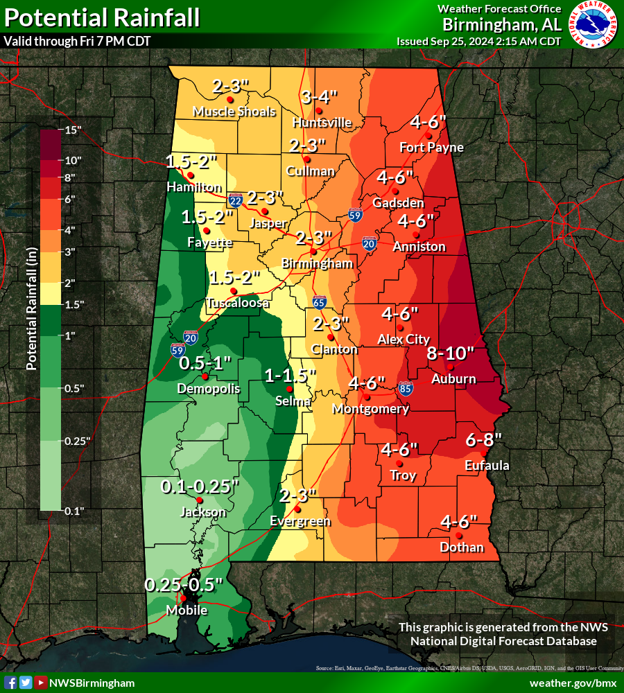
Heavy rainfall is the primary concern from Hurricane Helene, with totals ranging from 4 to 8 inches, and isolated amounts up to 10 inches possible. The heaviest rainfall is expected along and east of I-65, which could lead to significant flash flooding and river flooding, particularly in flood-prone and urban areas.
Residents should be prepared for rapid rises in water levels, especially in low-lying areas and along rivers and streams.Flood-prone areas and urban locations are particularly at risk.
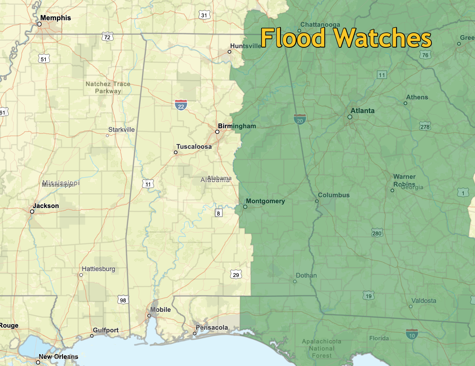
Flood watches have been issued.
TORNADOES:
The tornado risk from Hurricane Helene remains minimal at this time, with the greatest threat currently expected to stay to the east of Alabama. However, isolated, brief tornadoes cannot be ruled out, particularly in outer rain bands that could develop as the storm moves inland. Residents in eastern and southeastern Alabama should remain vigilant and stay tuned to weather updates, as conditions can change rapidly. It’s essential to have a reliable way to receive tornado warnings, such as a weather radio or smartphone alerts, and know where to take shelter quickly if a warning is issued.


