


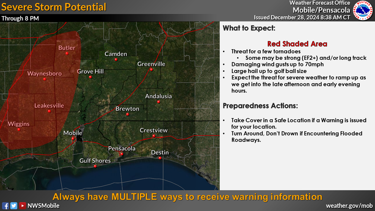
Partners, we continue to wait for things to get going over here. Recent WoFS ensemble guidance suggests we will see a potential uptick in activity across southeastern Mississippi in the next few hours. This coincides with the expectation for richer low level moisture to move northward over the next few hours through this area. If we can get a mature supercell thunderstorm to develop all severe hazards are possible with damaging wind gusts to 70mph, large hail to golf ball size, and tornadoes (potential for a long track and/or EF2+ tornado exists). As we head into this evening, forcing steadily increases and our thunderstorm coverage will begin to increase from west to east. We still expect several discrete supercells through the early evening into overnight hours followed by a QLCS during the late evening into overnight hours. In the discrete storms, hazards remain the same as they were during the afternoon hours. For the QLCS, the potential remains for some strong tornadoes, but the damaging wind threat (including some 75+mph gusts) ramps up significantly. The hail threat will be low in the QLCS, but the discrete supercells will still be capable of producing large hail. The greatest threat remains west of the I-65 corridor through 8pm CST.


