


We’ve got another severe storm rolling through portions of north central and northeastern Alabama this afternoon, so let’s get you up to speed.
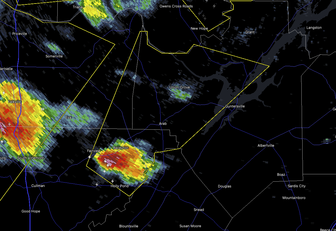
As of 3:49 PM, the National Weather Service in Huntsville has issued a Severe Thunderstorm Warning for northwestern Marshall County, northeastern Cullman County, and southeastern Morgan County. This warning runs until 4:45 PM.
At the time of the warning, a strong thunderstorm was located near Holly Pond, about 10 miles southwest of Arab, and it’s crawling to the northeast at around 25 miles per hour. This storm has the potential to produce 60 mile per hour wind gusts and quarter-size hail, based on radar estimates.
If you’re in Guntersville, Arab, Union Grove, Baileyton, Morgan City, or any of the surrounding communities like Hulaco, Joppa, and Ryan Crossroads, it’s time to take cover. Winds this strong can snap tree limbs, damage shingles, and toss around unsecured outdoor items, and that hail can certainly ding up your car in a hurry.
Best bet is to move to a sturdy building — go to an interior room on the lowest floor and stay put until the storm passes. We’ll be keeping an eye on this one, and we’ll pass along any updates as soon as they come in. Stay safe, and keep that weather radio or reliable source handy.


