


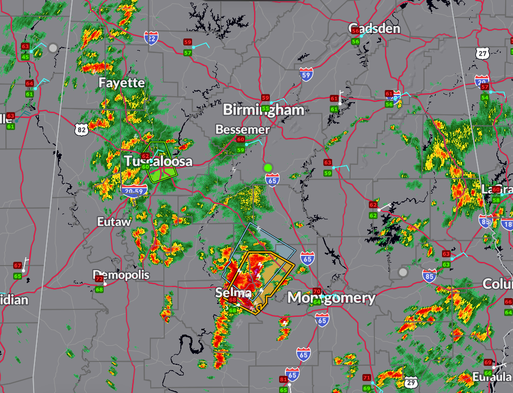
The National Weather Service in Birmingham has issued a Severe Thunderstorm Warning for northeastern Dallas and western Autauga counties until 6:45 PM.
A storm near Gardner Island is moving northeast at 20 mph, with the potential to produce quarter-size hail and wind gusts up to 60 mph.
Locations in the path include Selma, Valley Grande, Mulberry, and parts of the Craig Field and Memorial Stadium area.
Seek shelter indoors and stay alert for updates.
A Flash Flood Warning remains in effect until 7:15 PM for southwestern Tuscaloosa County, where thunderstorms have produced heavy rainfall.
Radar estimates indicate ongoing flash flooding in the Tuscaloosa and Northport areas, including the University of Alabama, Bryant-Denny Stadium, Shelton State, and surrounding low-lying and poor drainage locations.
Motorists should avoid flooded roads and remain alert as additional heavy rain is possible.


