


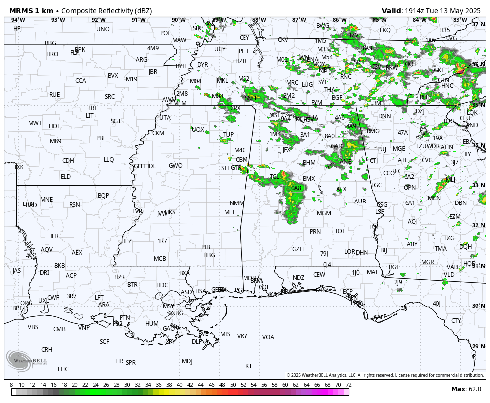
RADAR CHECK: Areas of rain and a few thunderstorms are moving eastward across the northern 2/3 of Alabama this afternoon… the southern third of the state is dry with a partly to mostly sunny sky. Showers will end after sunset tonight; temperatures will drop into the low to mid 60s early tomorrow morning.
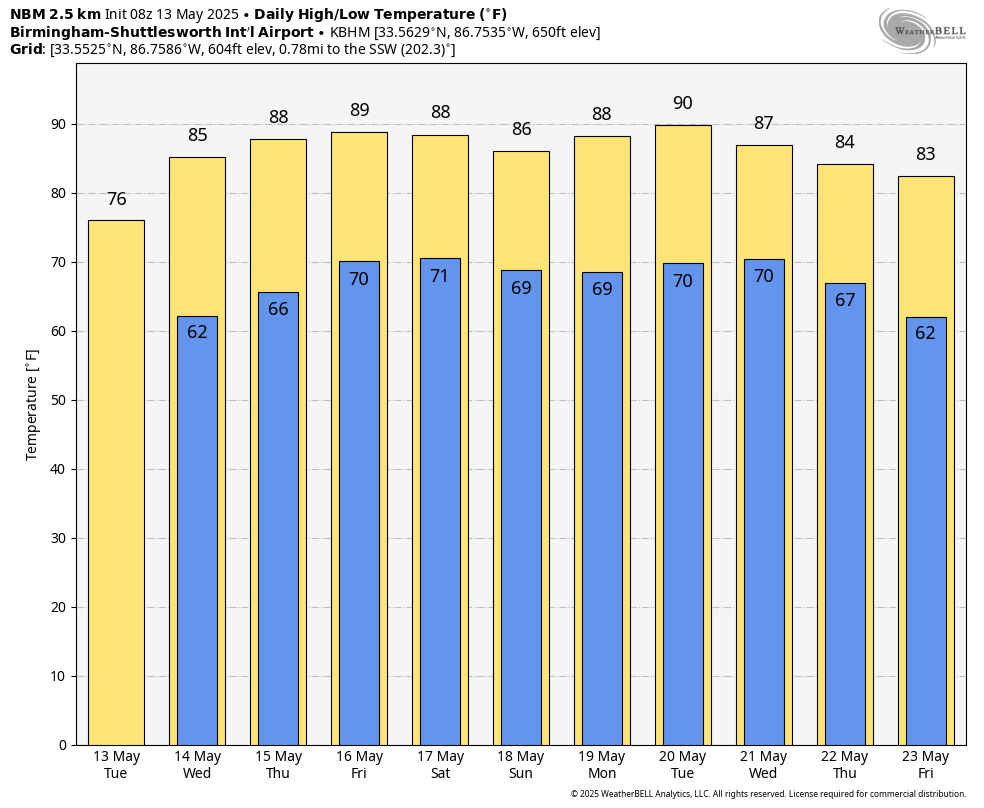
REST OF THE WEEK: As the upper low continues to move away, most of the state will be dry tomorrow with only isolated afternoon showers over the northern and eastern counties. The weather also begins to warm up with highs in the 80s statewide.
Thursday will be a mostly sunny day, and on Friday most of the day will be dry and very warm. A cold front could push a few thunderstorms into the northern quarter of Alabama Friday night, some of those could be strong. Expect highs in the 87-90 degree range.
THE ALABAMA WEEKEND: That surface front will become nearly stationary just north of Alabama, so we will mention some risk of random, scattered showers or storms over the northern half of the state Saturday and Sunday (mostly during the afternoon and evening hours). Not as wash-out at all, and nothing like the big rain we saw this past weekend. Most of South Alabama should be dry both days, and afternoon temperatures will be mostly in the mid to upper 80s.
NEXT WEEK: Warm weather continues through the week with highs in the 86-91 degree range. We will have a few days during the week with a risk of scattered afternoon and evening storms, but no sign for now of any really widespread rain or severe weather threats. Most of the really active weather will likely be north of Alabama thanks to an upper ridge near the Gulf Coast… see the video briefing for maps, graphics, and more details.
ON THIS DATE IN 1980: An F3 tornado ripped directly through the center of Kalamazoo, Michigan, killing five people, injuring 79, leaving 1,200 homeless and causing $50 million in damage.
ON THIS DATE IN 1995: This outbreak produced tornadoes extending from the Mississippi River near Burlington, Iowa, to the west of Bloomington, Illinois. Two violent tornadoes, each ranked at F4 intensity, were reported.
Look for the next video briefing here by 6:00 a.m. tomorrow…


