Watching Action To The Northwest
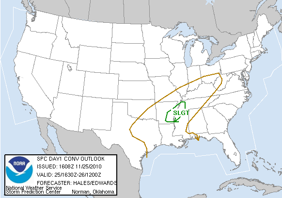
SPC has placed parts of the Mid-South, including the Memphis area, under a slight risk of severe weather for the next 6 hours…
This is from the NWS Memphis chat session…
MEG continues Tornado Warning for Dyer, Lake [TN] and Pemiscot [MO] till 1:45 PM CST …AT 105 PM CST…NATIONAL WEATHER SERVICE DOPPLER RADAR CONTINUED TO INDICATE A TORNADO. THIS TORNADO WAS LOCATED NEAR AYERS…OR 8 MILES SOUTH OF CARUTHERSVILLE…MOVING NORTHEAST AT 55 MPH.
This tornado will pass north of Dyersburg, TN, which is well to the north of Memphis.
We will keep an eye on developments this afternoon… but it will be late tonight, probably after midnight, when this line of showers and storms arrives in Alabama, and they should be weaker by then and major severe weather issues are not expected.
Still looks like a good chance the rain will be over in Tuscaloosa by 1:30 tomorrow, when the Iron Bowl kicks off. And, tomorrow will be much colder with temperatures in the 40s all day.
Category: Alabama's Weather


