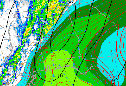
Severe weather analysis – 146 pm
It’s pretty clear from the strong temperature and dewpoint gradient in the analysis above where the front is…from near Demopolis to BHM area to Gadsden. Research has shown that on the near and just south of a front like this, atmospheric shear is enhanced. This explains the tornado warnings and rotating storms generally concentrated from south of Tuscaloosa earlier to Shelby county now. Given the location of the front, expect the tornado threat to stay south of I-59 for the most part, so people in Jefferson, Walker, Tuscaloosa, and Cullman counties can probably breathe easier. Lots of heavy rain coming.
South of the front, in places like Anniston, Springville, Alexander City, Jacksonville, and Roanoke, the threat for damaging winds and tornadoes will continue. However, the threat is not nearly what it was during the major outbreaks in the spring. That day, energy-helicity index was near 10, today it is only 1, and that is south of the front.
Category: Severe Weather


