

Western Jefferson Warning Continues
WESTERN JEFFERSON COUNTY WARNING
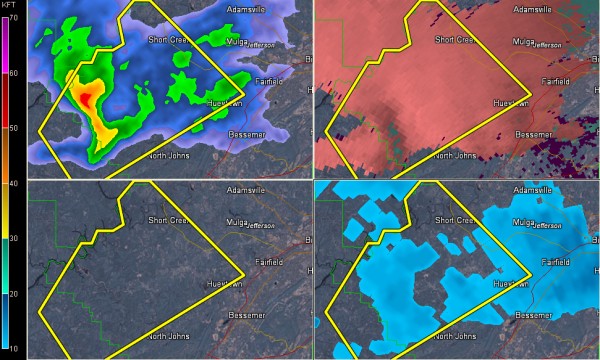
A severe thunderstorm warning continues for extreme northeastern Tuscaloosa and western Jefferson Counties. The rotation is now into western Jefferson County.
Trees were reported down just south of Moundville along highway 69 at 1:49 with this same storm. Winds were estimated at 50-55 mph.
This small storm has shown signs of rotation and is in a favorable location along the warm front. It is showing signs of a better updraft.
The storm will continue over western Jefferson County. It is heading toward Rock Creek, Concord, Hueytown, Sylvan Springs and Short Creek. It will pass west of downtown Birmingham heading toward Adamsville.
CLEARING OVER SOUTHWEST ALABAMA
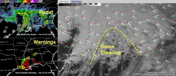
Some sunshine is breaking out over southwestern Alabama, as far north as Greene and Hale Counties. This clearing will provide a little sunshine that could warm things up just a bit and make things more unstable.
Category: Alabama's Weather, Severe Weather
About the Author (Author Profile)
Bill Murray is the President of The Weather Factory. He is the site's official weather historian and a weekend forecaster. He also anchors the site's severe weather coverage. Bill Murray is the proud holder of National Weather Association Digital Seal #0001 @wxhistorianSubscribe
If you enjoyed this article, subscribe to receive more just like it.


