

First Tornado Watch Of 2013
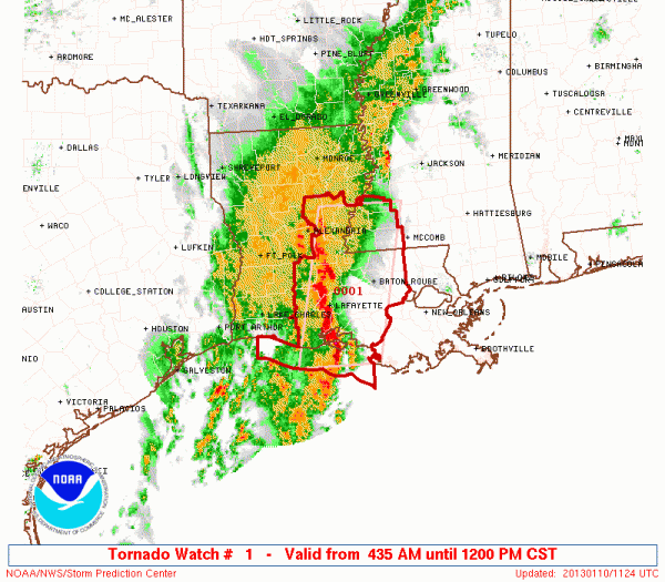
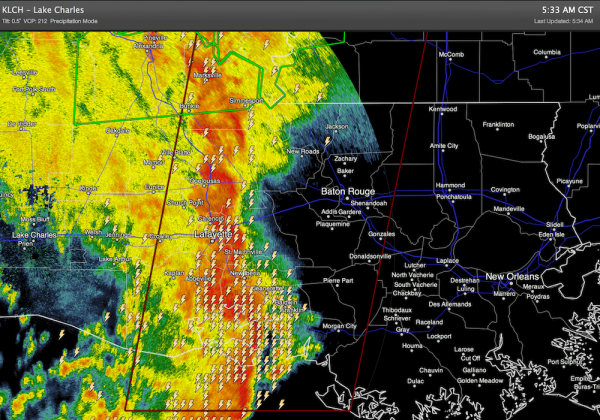
Tornado watch number one is up for much of Louisiana and SW Mississippi until 12 noon CST… a pretty nasty looking squall line is moving through that region this morning.
While showers and storms are likely across Alabama today and tonight, we don’t expect severe weather here.
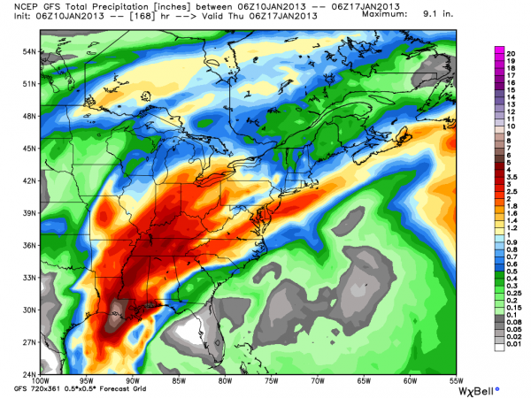
Our weather will be warm and wet through early next week, and there is still concern for a flooding situation early next week somewhere in Alabama as a surface front just creeps through. And, we expect a huge temperature contrast early next week as well from northwest to southeast. How much rain, and the temperatures will all depend on the location of the front, and there is some model disagreement.
Below is the latest forecast accumulated precipitation from the GFS through Wednesday evening of next week…
I am traveling back to Alabama this morning; Brian Peters will be along shortly with a fresh Weather Xtreme video and a detailed discussion. Stay tuned…
Category: Alabama's Weather
About the Author (Author Profile)
James Spann is one of the most recognized and trusted television meteorologists in the industry. He holds the AMS CCM designation and television seals from the AMS and NWA. He is a past winner of the Broadcast Meteorologist of the Year from both professional organizations.Subscribe
If you enjoyed this article, subscribe to receive more just like it.


