

Early Afternoon Update
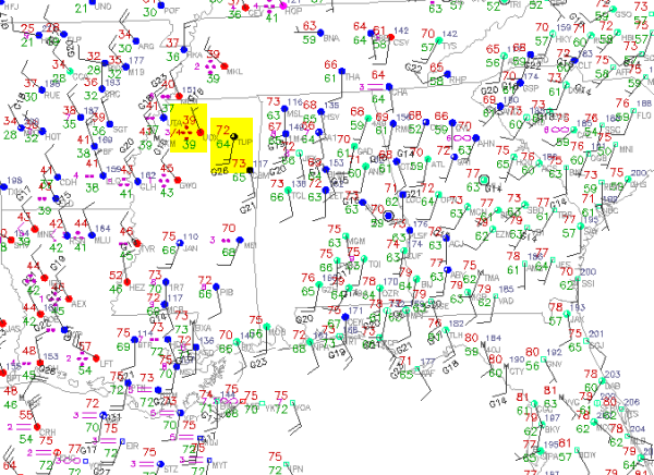
Cold front continues to slowly inch down the Interstate 22 corridor towards us this afternoon. Looking at the latest surface observations, we can really see how sharp a front this is as temperatures in Tupelo just a head of the front are in the low 70s. Less than 50 miles to the west, in Oxford the front has passed through with heavy rains, and the temperatures are in the upper 30s. A very dramatic drop over such a short distance, and that temperature drop is heading our way.
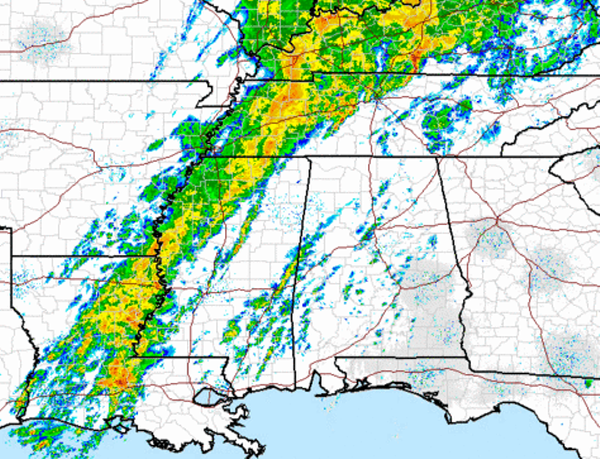
Looking at the radar, heavy rain is falling through out much of the Ohio River Valley, down into Central and West Tennessee and back into North Mississippi and all the way to the Gulf Coast. Scattered showers are developing in West Alabama ahead of the main band. The rain shield continues to move slowly east with the front and we can expect a wet evening and night across Alabama, and the temperatures will be falling making for some very raw days ahead. Would not be surprised to see portions of Central Alabama be placed under flood watches and/or warnings over the next 24 hours. A few thunderstorms could be strong, but we are not expecting widespread severe weather. If there is any severe storms they will be isolated.
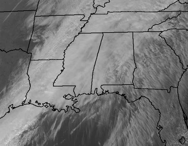
Satellite image has looked the same for the past few days, and with the slow movement of the front, we will stay socked in the clouds and conditions will remain gray and gloomy for several days. Clearing line is in Oklahoma and Texas will eventually make it to us by about Wednesday.
Category: Alabama's Weather
About the Author (Author Profile)
Macon, Georgia Television Chief Meteorologist, Birmingham native, and long time Contributor on AlabamaWX. Stormchaser. I did not choose Weather, it chose Me. College Football Fanatic. @Ryan_StinnetSubscribe
If you enjoyed this article, subscribe to receive more just like it.


