

Notes at 2:15 p.m.
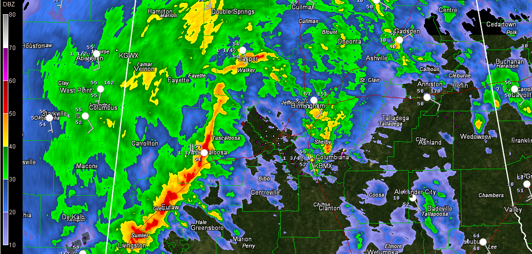
Storms across Central Alabama are producing plenty of booming thunder, heavy rain and strong gusty winds, but they are not severe.
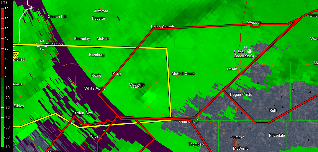
Storms are quite intense over South Central Mississippi near and south of a northeastward moving warm front. The storms near the front have not become surface based yet, but south of the warm front, there are more dangerous storms in the more unstable air over southern Mississippi. Several of those discrete storms have tornado warnings on them.
Alan Gerard at the NWS Jackson reports that there is a possible tornado moving into Bude MS southwest of Brookhaven. 80 knot gate to gate shear is indicated.
All of this activity will continue to lift east northeast across South Central Mississippi through the rest of the afternoon. There is an enhanced tornado threat between Jackson and New Orleans, to near the Alabama border northwest of Mobile.
We will be monitoring this activity and additional storms that will form through the evening to see if it becomes severe how in evolves as it gets into Alabama later.
A squall line will push across the state later tonight. That line of storms may produce damaging winds and an isolated tornado or two later tonight.
Heavy rain will be a threat with 1.5 to 2.5 inches of rain expected across the area tonight as the storms move through followed by a mass of moderate to heavy rain.
Category: Alabama's Weather, Severe Weather
About the Author (Author Profile)
Bill Murray is the President of The Weather Factory. He is the site's official weather historian and a weekend forecaster. He also anchors the site's severe weather coverage. Bill Murray is the proud holder of National Weather Association Digital Seal #0001 @wxhistorianSubscribe
If you enjoyed this article, subscribe to receive more just like it.


