

Severe Weather Risk for Extreme Eastern Alabama
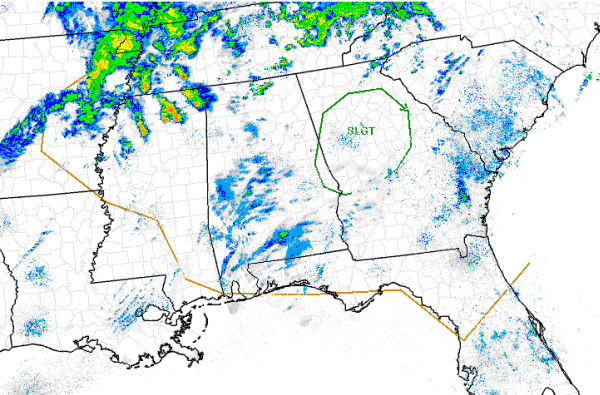
The SPC has outlined portions of extreme eastern Alabama in a slight risk for severe weather today. This risk includes portions of Randolph, Chambers, Lee and Russel Counties. The risk also includes much of north central Georgia including the metro Atlanta area.
There are a few ongoing elevated thunderstorms this morning across North Mississippi. This activity will continue to move east today across Alabama and should bring scattered showers and thunderstorm to much of the state. We will likely see some gusty winds and hail reports throughout the day, but most of the activity should remain below severe limits.
Low pressure over the Ohio River Valley is swinging a cold front across the state today. This will provide the uplift needed to get additional thunderstorms to develop. These storms should be out of the state by early this evening. Behind the front another shot of cold air for a couple of days, before warmer temperatures set in for the weekend.
Category: Alabama's Weather, Severe Weather
About the Author (Author Profile)
Macon, Georgia Television Chief Meteorologist, Birmingham native, and long time Contributor on AlabamaWX. Stormchaser. I did not choose Weather, it chose Me. College Football Fanatic. @Ryan_StinnetSubscribe
If you enjoyed this article, subscribe to receive more just like it.


