


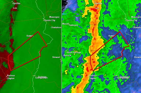
Another severe thunderstorm has developed across southeast Alabama with a possible tornado. This storm is moving to the Northeast at 35 mph and will be impacting areas northeast of Clayton and the worst part of the storm should stay just south of Phenix City but north of Eufaula.
THE NATIONAL WEATHER SERVICE IN BIRMINGHAM HAS ISSUED A
* TORNADO WARNING FOR…
NORTHEASTERN BARBOUR COUNTY IN SOUTHEAST ALABAMA…
SOUTHEASTERN RUSSELL COUNTY IN SOUTHEAST ALABAMA…
* UNTIL 1015 PM CDT
* AT 918 PM CDT…THE NATIONAL WEATHER SERVICE INDICATED A SEVERE
THUNDERSTORM CAPABLE OF PRODUCING A TORNADO. THIS DANGEROUS STORM
WAS LOCATED NEAR COMER…OR 8 MILES SOUTHEAST OF MIDWAY…AND
MOVING NORTHEAST AT 35 MPH.
* LOCATIONS IMPACTED INCLUDE…
SPRING HILL…HAWKINSVILLE AND BATESVILLE.
PRECAUTIONARY/PREPAREDNESS ACTIONS…
TORNADOES ARE DIFFICULT TO SEE AND CONFIRM AT NIGHT. TAKE COVER NOW.


