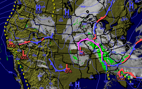
An area of low pressure over southwest Missouri continues to spin and lift slowly towards the northeast. From this low, an occluded front stretches from the Midwest into the Ohio Valley and down through the Tennessee Valley and into East Alabama. Behind the front much cooler air is moving into place. Along and ahead of the front widespread showers and a few thunderstorms are ongoing.
Heading through the rest of the afternoon, dry air and clearing skies will continue to work into Alabama. Temperatures will struggle to reach the 60s today as a cool northwest winds will be blowing. Tonight lows will settle back into the the upper 30s and low 40s.
Tomorrow, the upper-level low over currently responsible for the the clouds and rain over Arkansas and Oklahoma will be moving across Alabama. Expect clouds and scattered showers and a few thunderstorms to return to Alabama tomorrow. No severe weather is expected, but with the very cold air associated with the upper low, expect quite a bit of hail and graupel tomorrow.