

Severe Weather Threat for Northern Counties
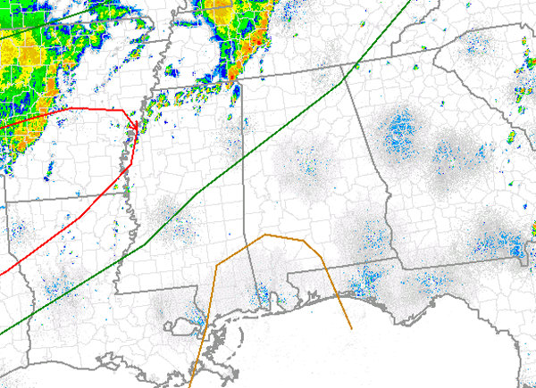
The latest day one convective outlook has been issued and the Storm Prediction Center has now included portions of northern Alabama in a slight risk for severe weather. Areas from Pickens, Fayette, Cullman, Marshall and De Kalb Counties and areas to the north and west are included in this risk for severe weather. Hamilton, Cullman, Hunstville, Muscle Shoals and Haleyville are some of the larger cities included in the risk.
A cluster of showers and thunderstorms continues to push east across the state of Tennessee. There are a few severe thunderstorm warnings with this complex. Daytime heating, a very warm moist and unstable air mass and lift provided by outflow boundaries will allow for showers and thunderstorms to develop. The main concern with any severe weather that develops will be damaging winds and large hail. The main tornado threat should remain to the west of Alabama as a moderate risk for severe weather has been issued for areas from the Mississippi River back to Texas.
Category: Alabama's Weather, Severe Weather
About the Author (Author Profile)
Macon, Georgia Television Chief Meteorologist, Birmingham native, and long time Contributor on AlabamaWX. Stormchaser. I did not choose Weather, it chose Me. College Football Fanatic. @Ryan_StinnetSubscribe
If you enjoyed this article, subscribe to receive more just like it.


