

Storms and a Front Dropping South
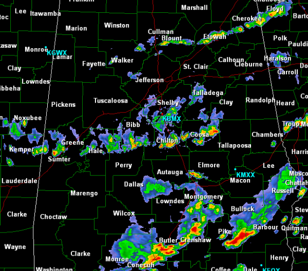
A quick look at the radar this evening continues to show showers and storms dropping south. There is a band of showers that have developed along the front itself and are making their way into Walker, Blount and Etowah Counties and will continue a southward motion the rest of the evening. More intense and organized activity is off to the south of Birmingham around Clanton and Rockford. The most intense storms across the state are south of the Montgomery area near Troy, Union Springs and Clayton. The showers and storms this evening are expected to stay below severe limits.
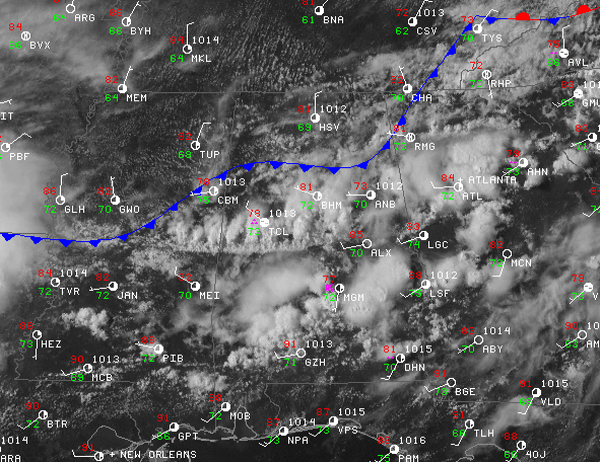
The cold front has made its way into north Alabama and is slowly dropping south as well. At last look, the front was analyzed from Chattanooga down to Gadsden over to around Cullman and west to Columbus, Mississippi. Areas across the Tennessee Valley are seeing sunshine this evening and north winds are bringing in drier air to that part of the state. Temperatures will not be cooler behind the front but dew points will certainly be lower over the next few days. Lower dew points will make afternoon highs not so uncomfortable as less humid conditions will occur. Dew points are dropping across North Alabama and that drier air is heading into Central Alabama overnight. The satellite image shows that areas behind the front are clearing out, but ahead of the front there are higher cloud tops associated with the shower and thunderstorm activity in central and south Alabama.We will finally see mostly sunny and dry conditions tomorrow as the front will be well south of the Birmingham Metro.
Category: Alabama's Weather
About the Author (Author Profile)
Macon, Georgia Television Chief Meteorologist, Birmingham native, and long time Contributor on AlabamaWX. Stormchaser. I did not choose Weather, it chose Me. College Football Fanatic. @Ryan_StinnetSubscribe
If you enjoyed this article, subscribe to receive more just like it.


