

Isolated Showers Forming
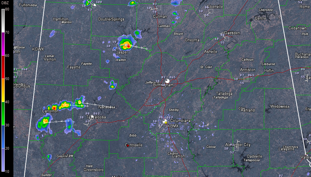
Isolated showers are forming across western Alabama this afternoon ahead of a southeastward diving upper disturbance that is near Memphis at this hour. They extend northward along a curved line into Central Tennessee west of Nashville.
The heaviest shower was just northeast of Jasper in Walker County, moving east toward Arkadelphia. No lightning yet, but it probably isn’t far away.
Showers are increasing quickly over Pickens County, extending into northwestern Tuscaloosa County. The main cells are north of Aliceville, northeast of Carrollton and between Gordo and Reform. Movement is toward the east. Will probably see lightning and thunder in the Tuscaloosa area within the hour.
Showers will continue to develop and some of them will grow into storms as we go through the afternoon hours. They may linger a little linger than usual this evening thanks to the parent disturbance.
Category: Alabama's Weather
About the Author (Author Profile)
Bill Murray is the President of The Weather Factory. He is the site's official weather historian and a weekend forecaster. He also anchors the site's severe weather coverage. Bill Murray is the proud holder of National Weather Association Digital Seal #0001 @wxhistorianSubscribe
If you enjoyed this article, subscribe to receive more just like it.


