

Showers Continue
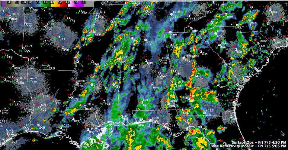
Most of the shower and thunderstorm activity has been over the western part of Alabama today, Some heavy rain moved northward out of the Florida Panhandle, but weakened as it moved away from the coast.
To the east, showers and thunderstorms have been fired this afternoon along a wave of energy coming around the Bermuda high. The southeasterly flow will allow these to track into Alabama tonight. The good news is that the instability over the state is low, so whether they will hold together very well remains to be seen.
But a moist airmass remains in place across the area, with over two inches of precipitable water across much of West Central and Southwestern Alabama. Showers and storms will likely form again overnight, bringing a continued threat for heavy rain to the area through much of tomorrow.
Category: Alabama's Weather
About the Author (Author Profile)
Bill Murray is the President of The Weather Factory. He is the site's official weather historian and a weekend forecaster. He also anchors the site's severe weather coverage. Bill Murray is the proud holder of National Weather Association Digital Seal #0001 @wxhistorianSubscribe
If you enjoyed this article, subscribe to receive more just like it.


